The Inside Passage — Klemtu to Bella Bella — July 30, 2019

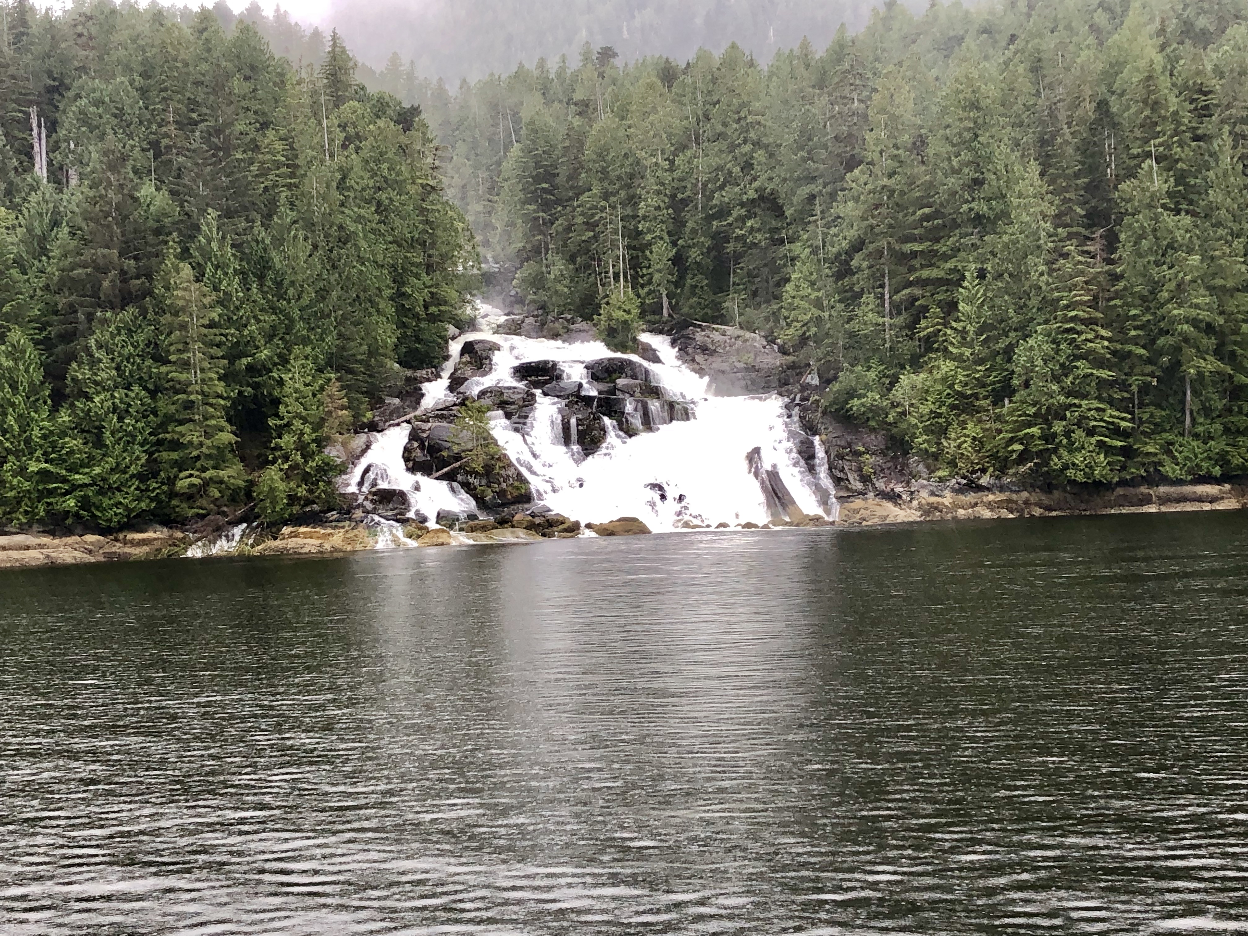
A minus tide has exposed a wide swath of rocky beach where juvenile eagles scavenge clams and crabs in the early morning light.

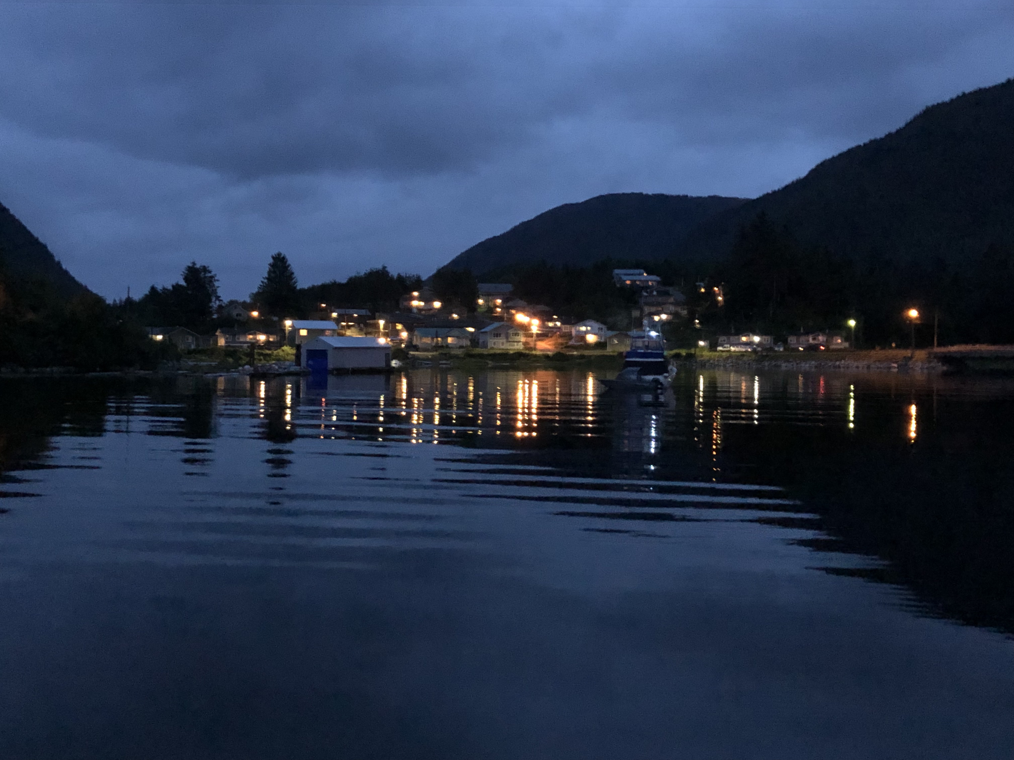
Thankfully, our late-night anchoring held firm and we are still floating in a shy fifteen feet of water. If we had anchored closer to shore, our stern would be stuck in the mud. Chris’ careful reading of the chart and mindful calculations of the tide have kept the Well Sea well situated.

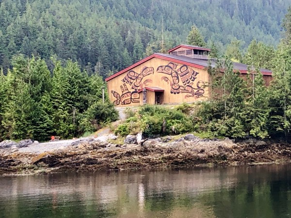
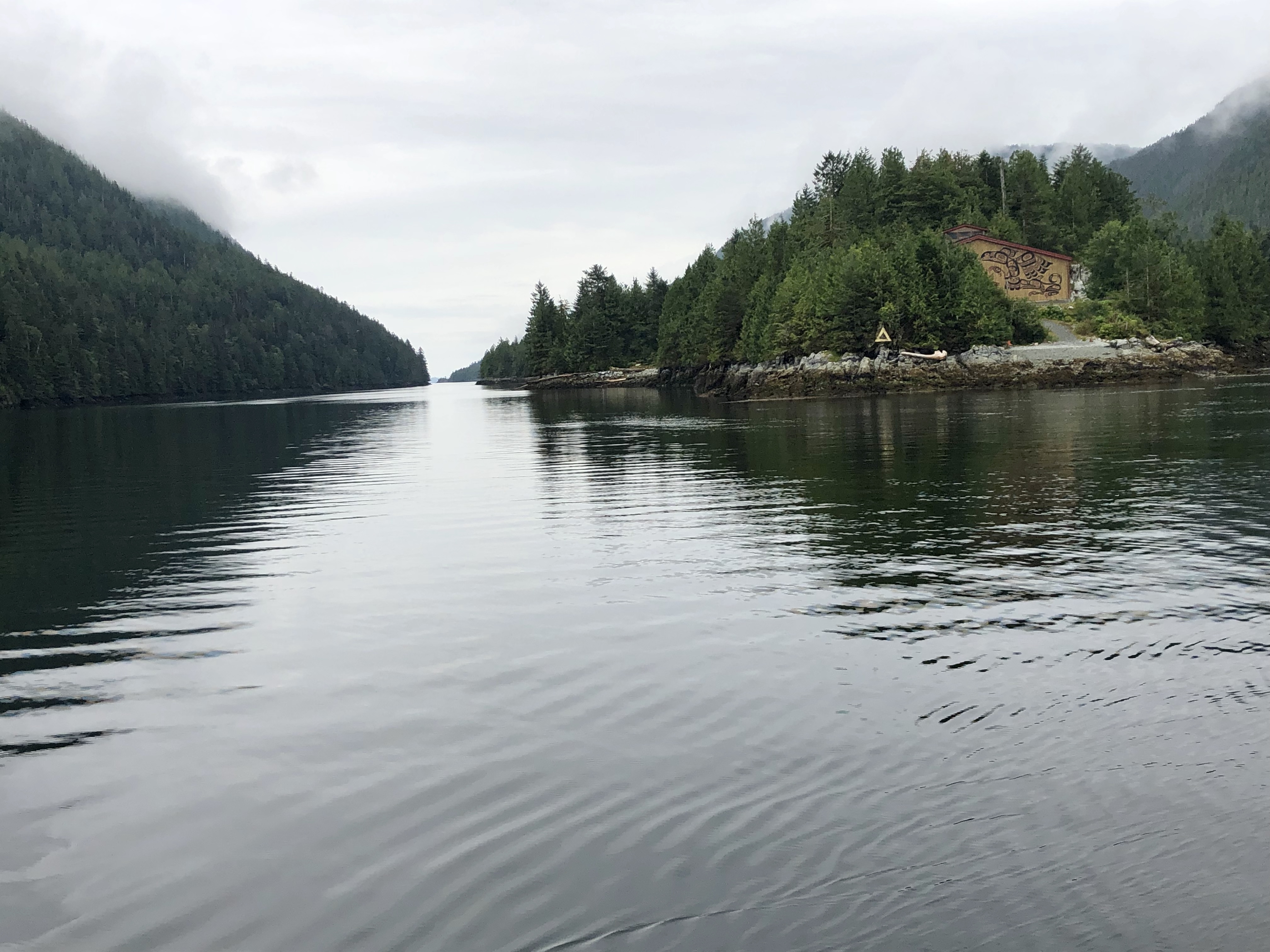
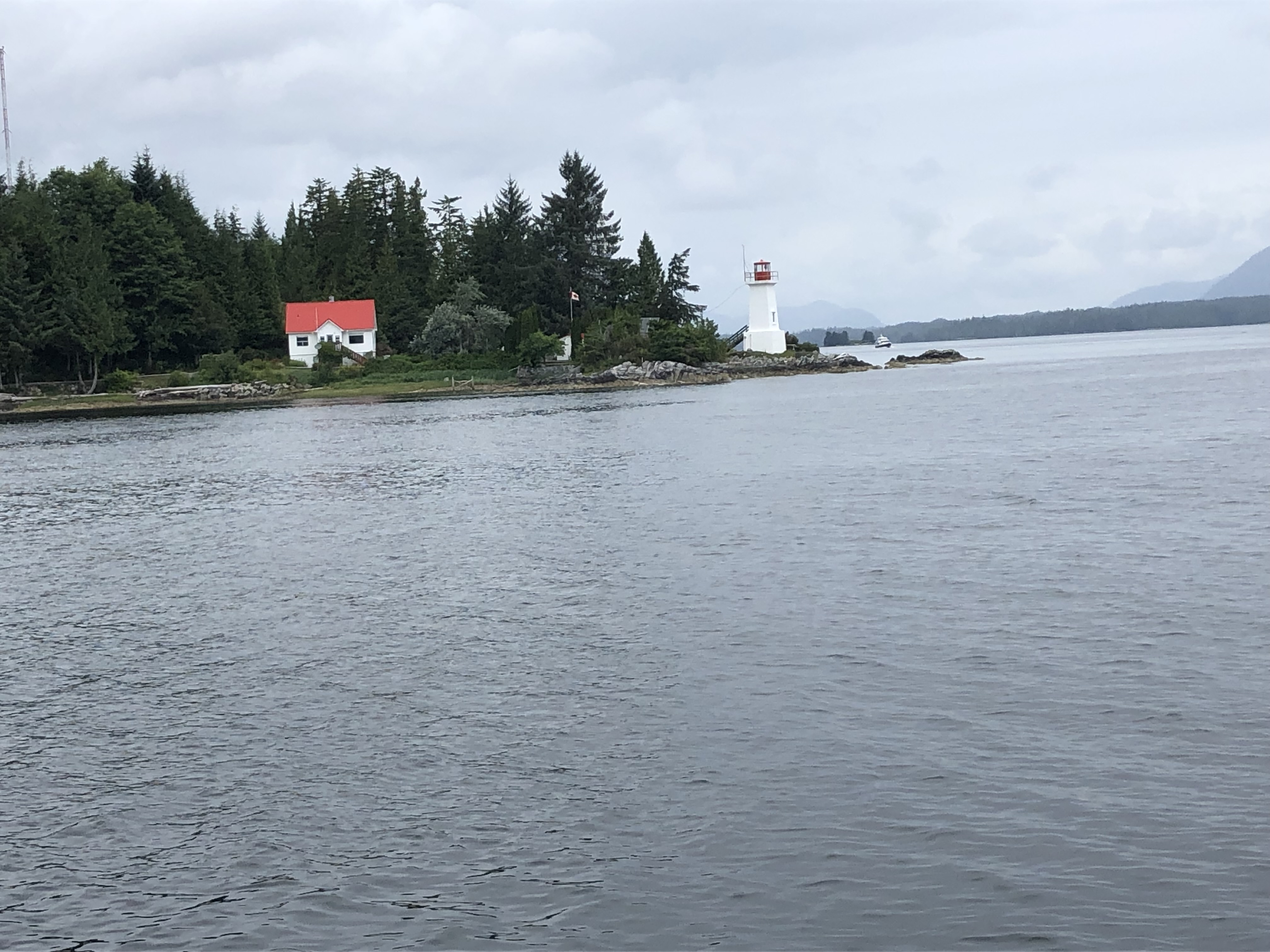
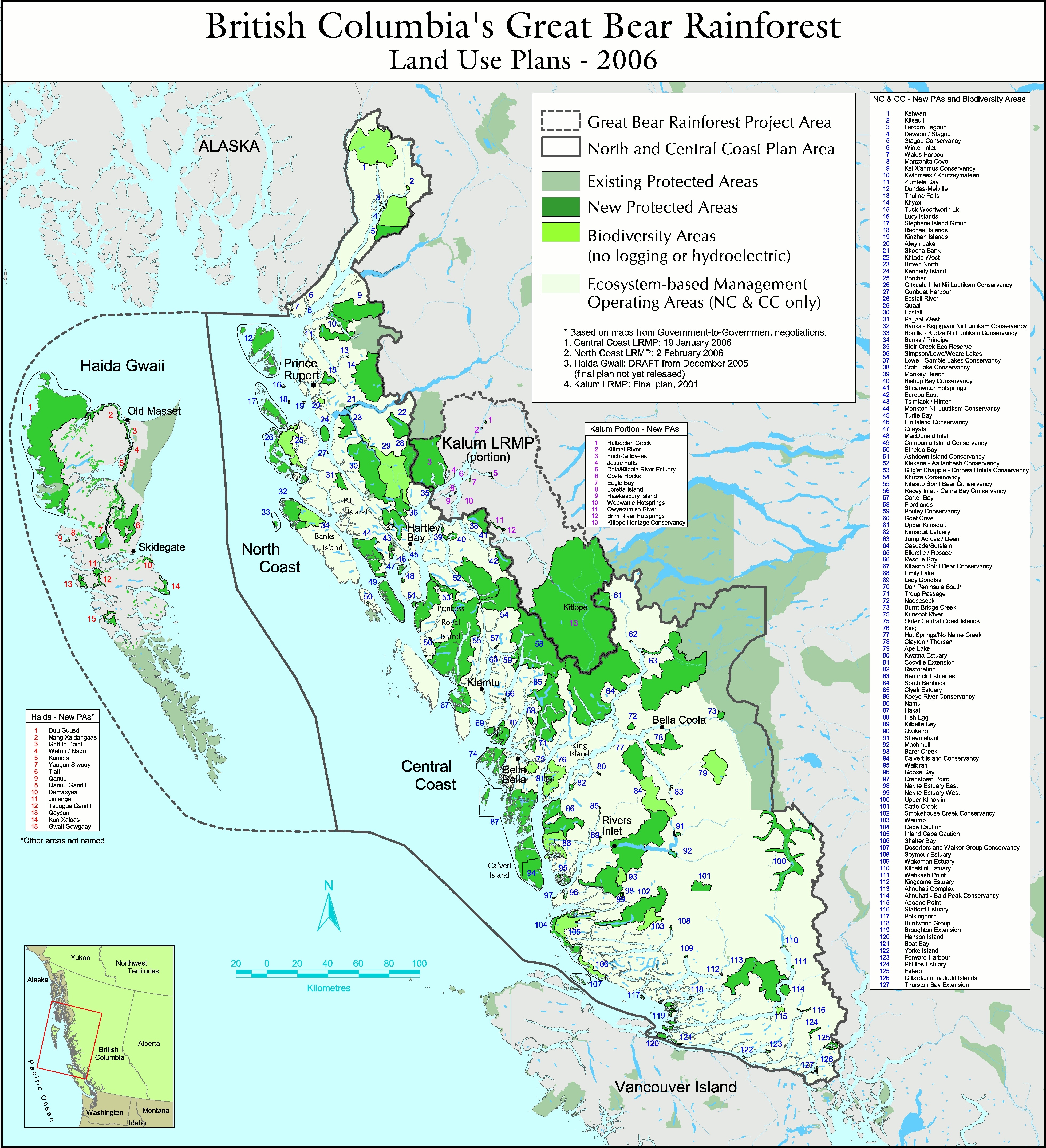
A slight mist is lifting, and the black and red talismans painted on the Klemtu Longhouse are now distinct. The Kitasoo and Xai’xais are two of the fifteen Tsimshian nations that call the Great Bear Rainforest home. Thousands of years ago, the Kitasoo people lived in villages scattered along rivers, bays and inlets of the outer central coast.  The Xai’xais settled in the large river systems on the mainland of the central coast. They were not nomadic tribes due to the abundance of natural resources and plentiful marine life.

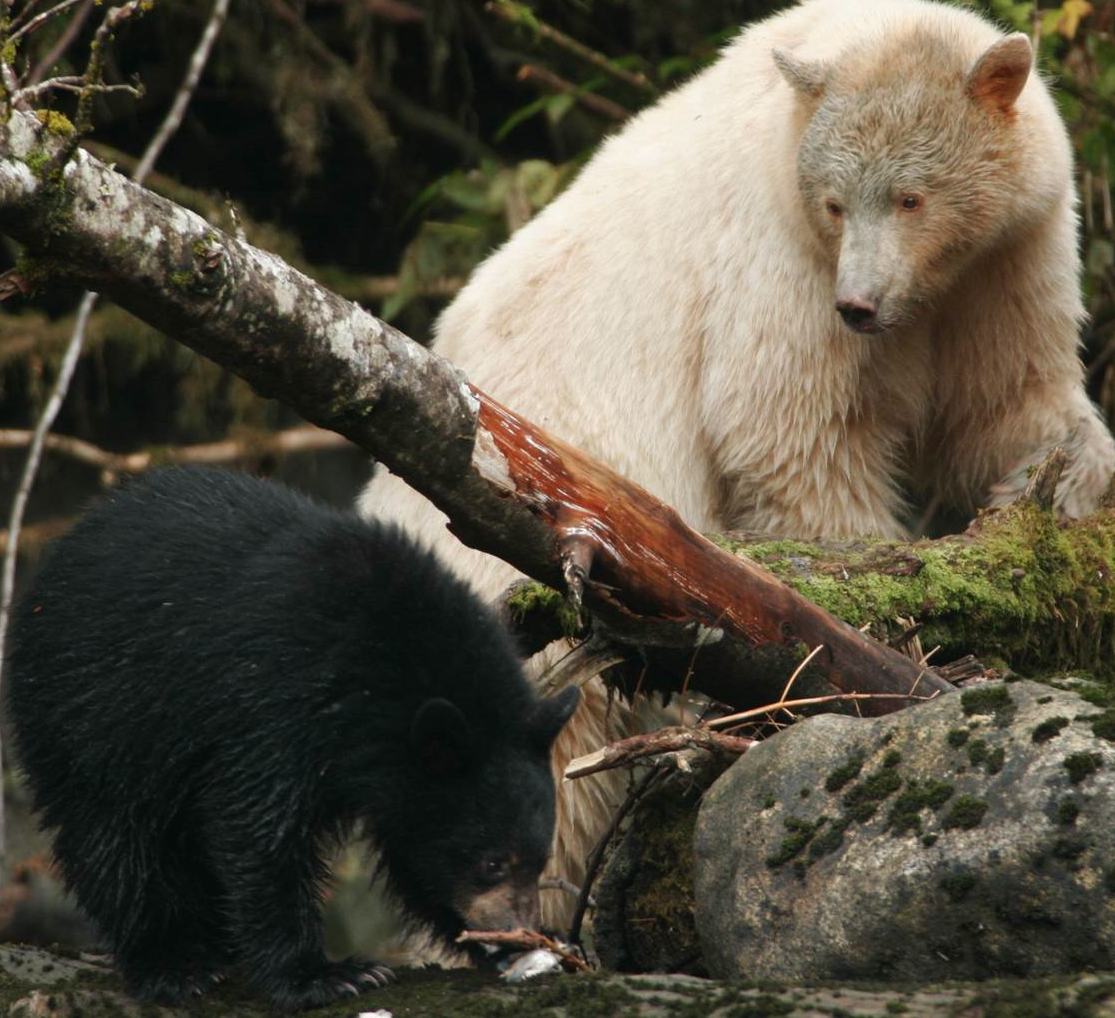
According to tribal legends, Raven made one in every ten black bears white to remind the people of a time when glaciers covered the world so they would become thankful stewards of the bountiful land. For many years, tribal elders rarely spoke of the legendary and elusive Spirit Bear for fear it would be hunted into extinction if word spread of its existence. Yet today the opposite has happened: tourists from across the globe travel to Spirit Bear Lodge in Klemtu for a chance to glimpse the rare and endangered Kermode Bear in its natural habitat (it’s estimated that only 50 to 100 of these white bears exist).

Around 1875, the two tribes began to settle in Klemtu (a word meaning “blocked passage”) to take advantage of its strategic location for trade and to supply cordwood to steamships traveling the Inside Passage. In the 1830s, exposed to viruses from the colonialists, the Kitasoo and Xai’xais villages suffered devastating losses. When the Canadian government established the reserve system and moved remaining “Indians” in the territory to Klemtu, the two distinct tribes formed one First Nation.

The natural ecosystems in the region also suffered from colonialism. For more than 100 years, resources such as fish and forests, were unsustainably extracted with no compensation provided to the Kitasoo/Xai’xais people. Klemtu, like other First Nation communities along the coast, suffered extensive economic, social, and cultural damage throughout this period.

Starting in the 1980s, the tribes began developing a community-based economy. Using revenue from a commercial herring spawn on their kelp license and securing additional community-owned licenses for sea cucumbers, urchin, prawns and other marine life, they were able to build a seafood processing plant. Next, they began farming salmon which provided significant new revenues and jobs. Eventually, management over forest harvesting in the territory led to acquisition of forest tenures and additional revenues.

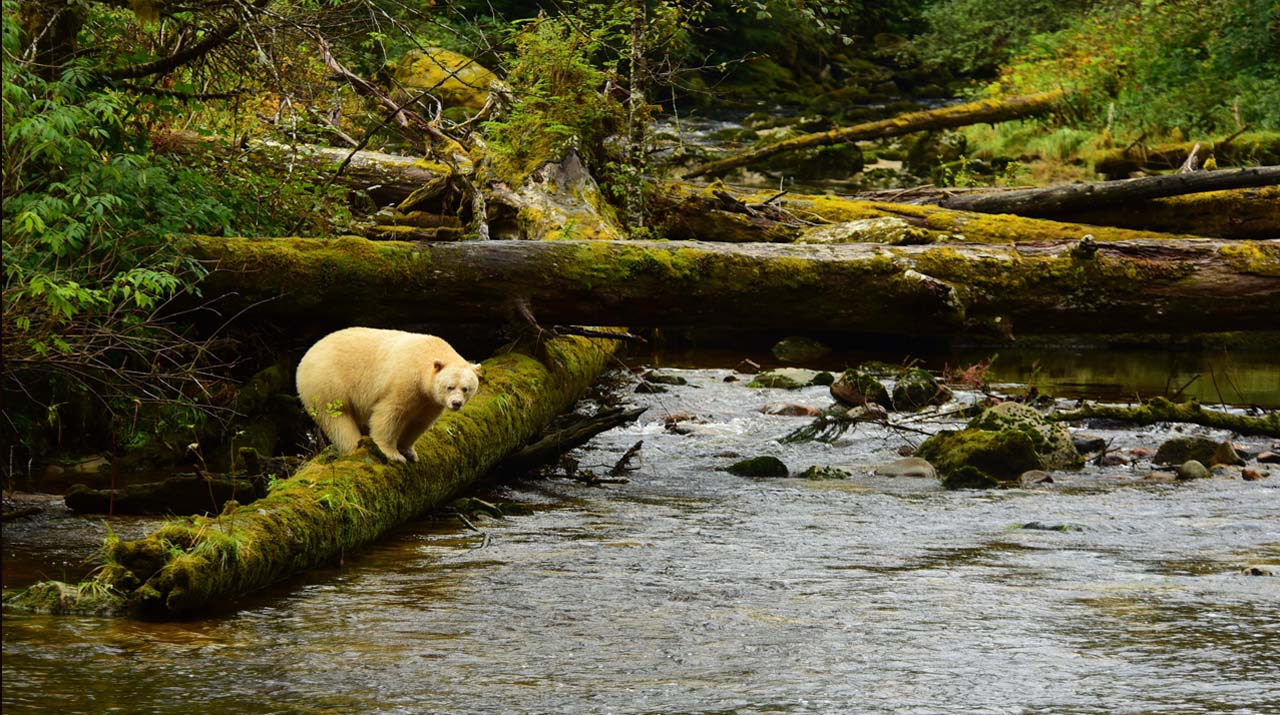
Today, Spirit Bear Lodge is a worldwide model of conservation-focused ecotourism that minimizes impact on the land and animals in this remote corner of Canada. Recognized as a best practice model for Indigenous community-based tourism, the revenues from the Lodge support the protection of the Kitasoo/Xai’xais culture, language, and traditions. As the Lodge grew it helped the Nation play a much bigger role in stewardship and management of their territory. Ecotourism activities at Spirit Bear Lodge are aligned with Kitasoo/Xai’xais cultural values. “The elders always say what we have is not ours, we’re just holding it for the next generation.”

Our next segment is a short run this morning, so we linger here in Klemtu while I bake a batch of cinnamon rolls and fix a leisurely breakfast of fried Italian Coppa ham and scrambled eggs with capers and feta cheese.

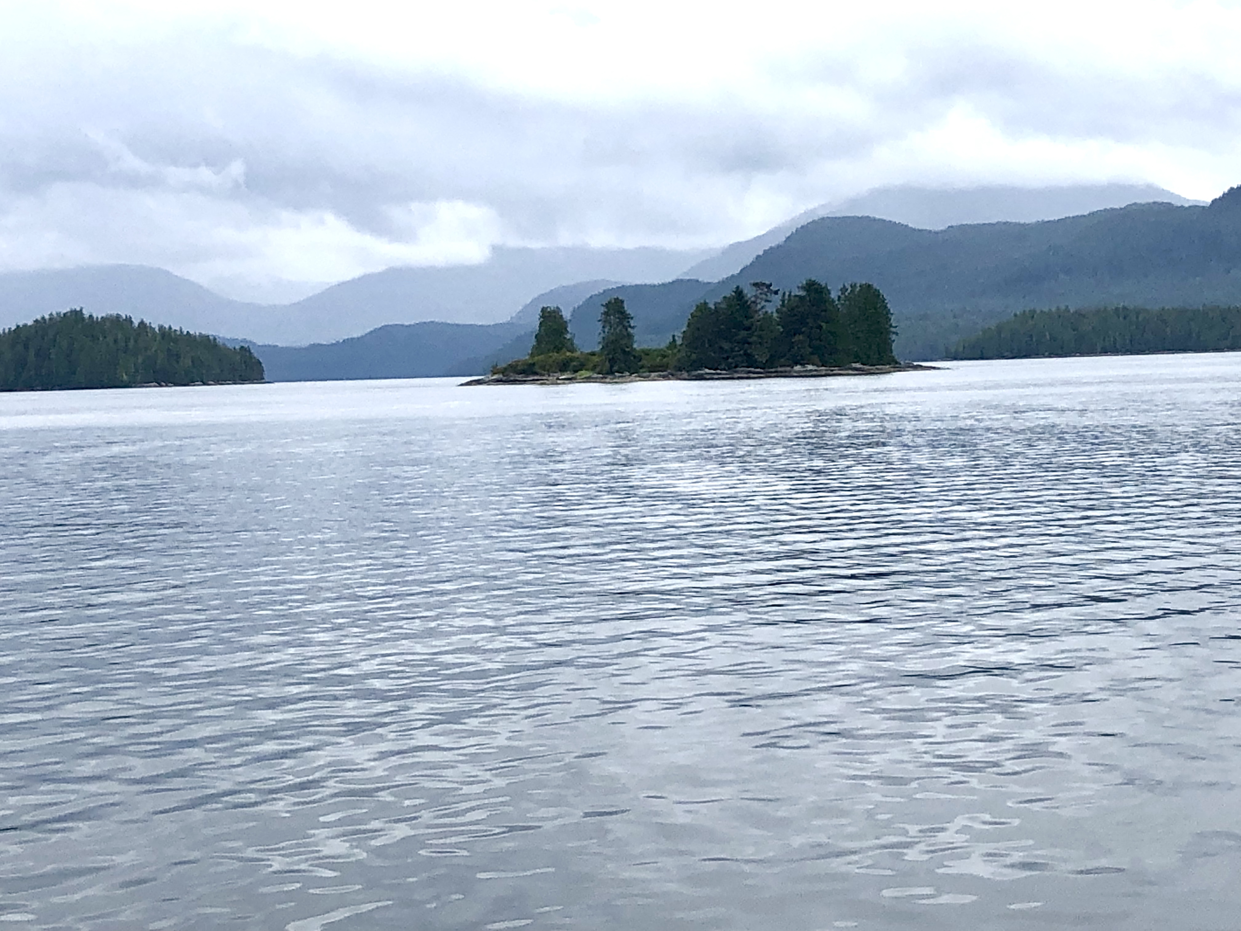
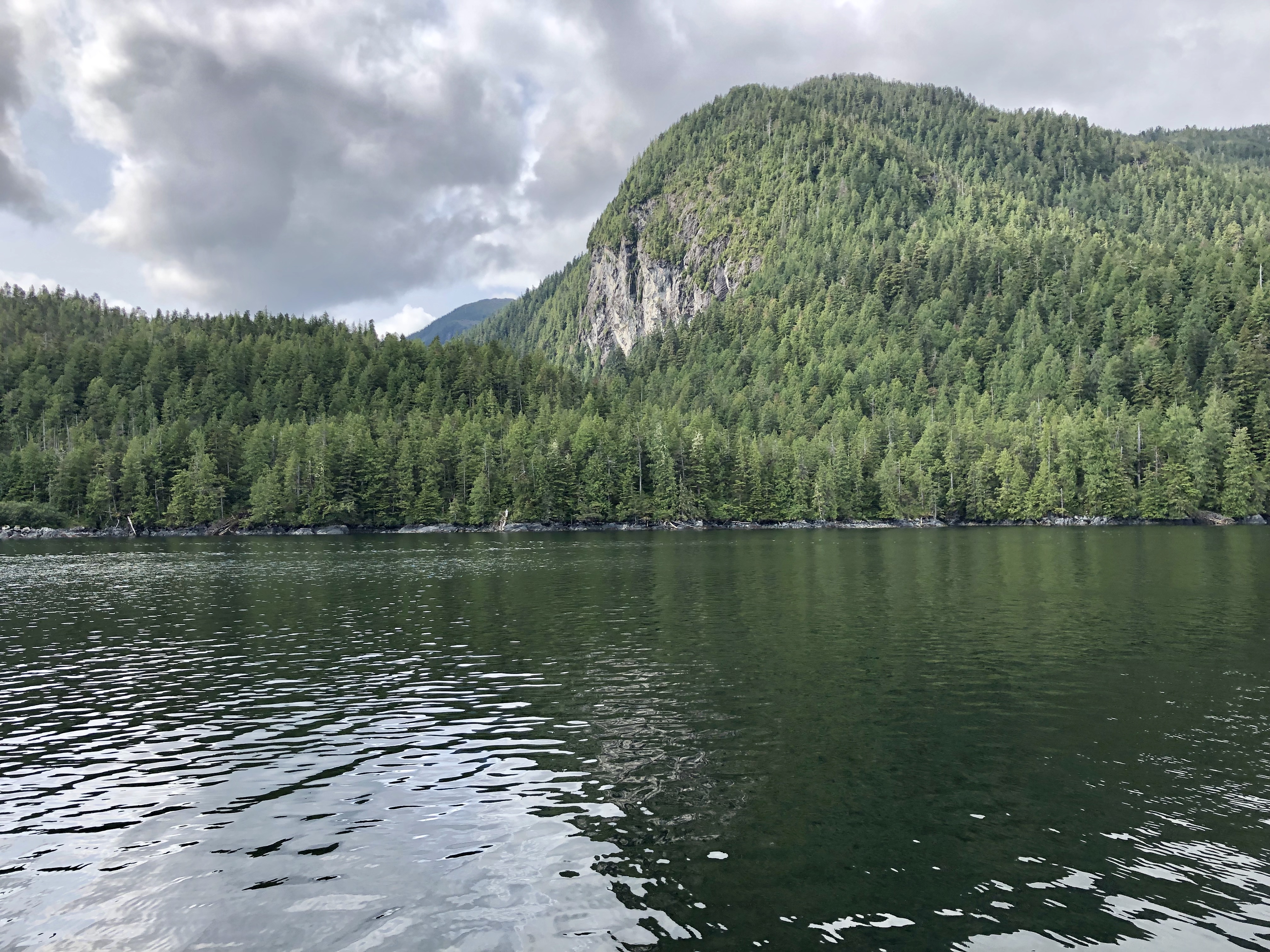
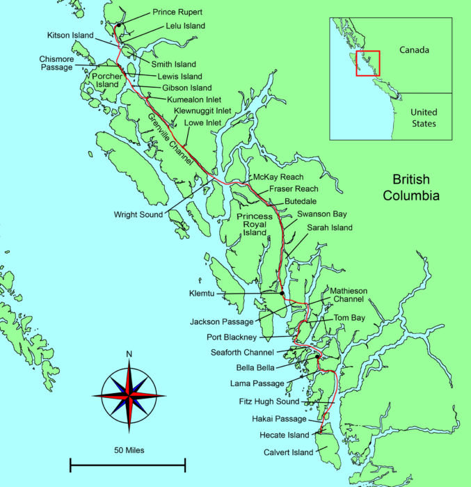
After retracting and hosing off our muddy anchors, we are underway.  I pull in the fenders as we round the promontory of the Longhouse and slip into peaceful Tolmie Channel. Cone Island shelters Trout Bay—Klemtu actually sits on Swindle Island, part of the volcanic cluster called the Milbanke Sound Group.  Kitasu Hill on the Pacific side of the island is a monogenetic basalt cinder cone that produced lava flows thousands of years ago. A monogenetic volcanic field consists of volcanoes which erupt only once, as opposed to polygenetic volcanoes which erupt repeatedly over a period of time. Monogenetic volcanoes occur where the supply of magma is low or where vents are not close enough to the surface or large enough to develop systems for continuous feeding of magma.

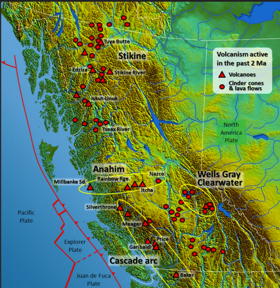
Part of the Pacific Ring of Fire, the western mountain ranges in California, Oregon, Washington, British Columbia are home to more than 100 polygenetic volcanoes including Mount Baker, Mount Rainer, Mount St. Helens, Mount Adams, Mount Hood, Mount Bachelor, Mount Jefferson, Mount McLoughlin, Mount Shasta, and Mount Lassen. Make no mistake, while many are dormant, these are still active volcanoes—Lassen erupted violently in 1917 and Mount St. Helens stunned the world in 1980.

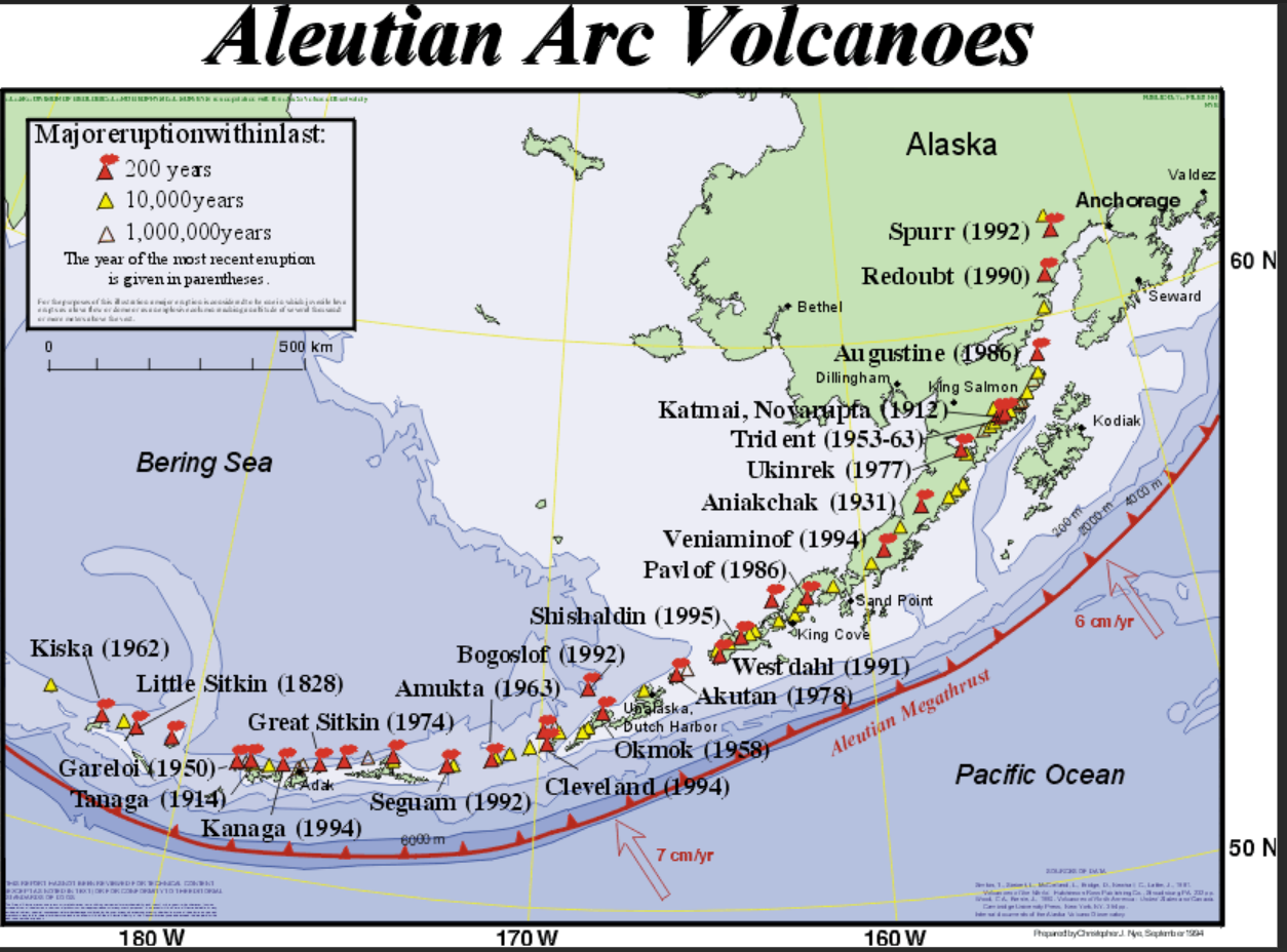
There are more than 130 volcanoes in Alaska and dozens have erupted in the last 100 years. Mounts Shishaldin on Umimak Island, a picturesque volcano, symmetrical and smooth like Mount Fuji in Japan, erupted in 2020. The tallest mountain peak in the Aleutian chain of islands rising over 9000-feet above sea level, its upper portion is covered year-round in glacial snow and ice, and a thin stream of smoke continually rises from the crater. At over 10,000 feet high, major eruptions of the imposing Mount Redoubt, just west of Cook Inlet, grounded jetliners in Anchorage for days (1989 and 2009). 

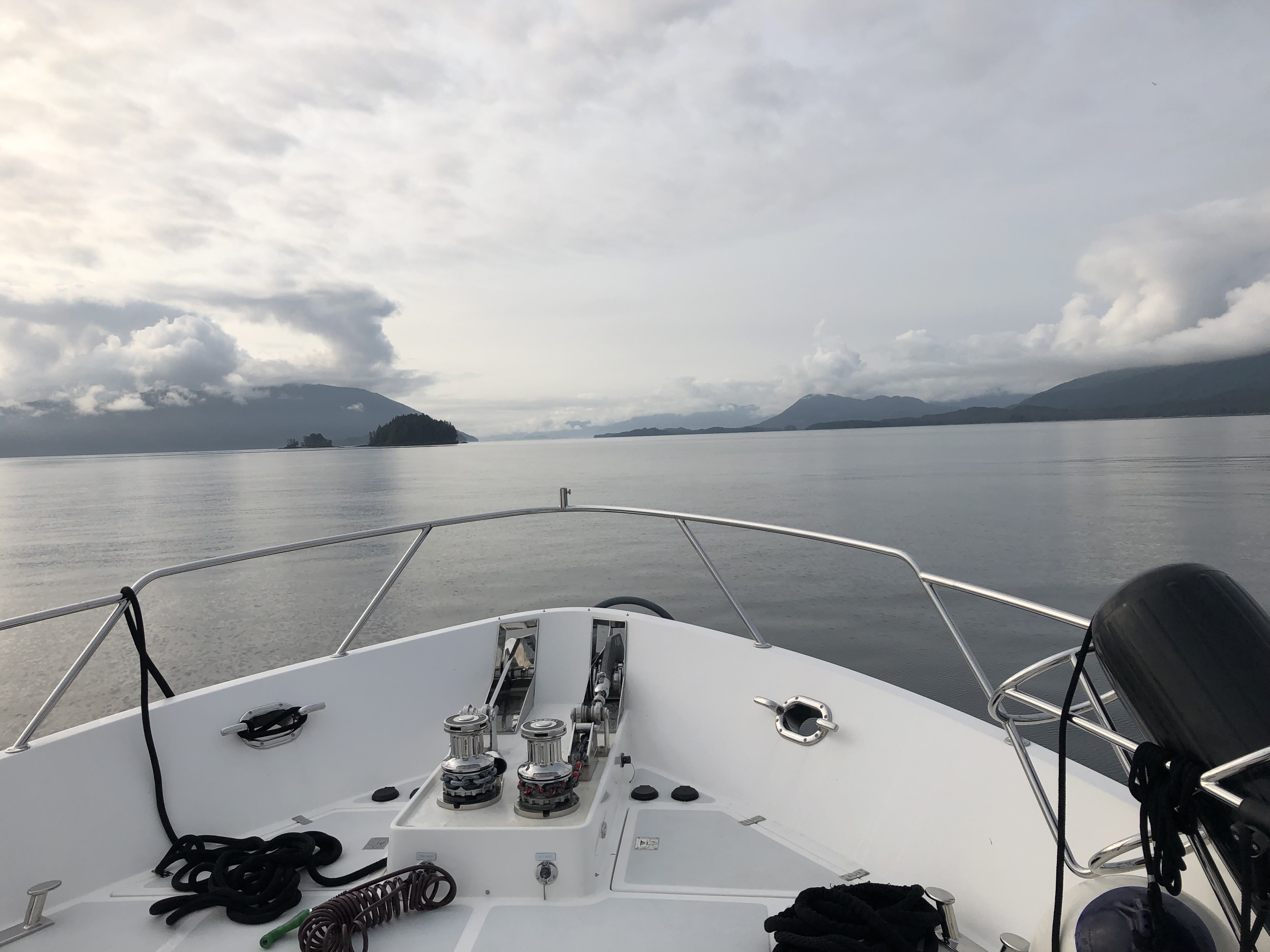
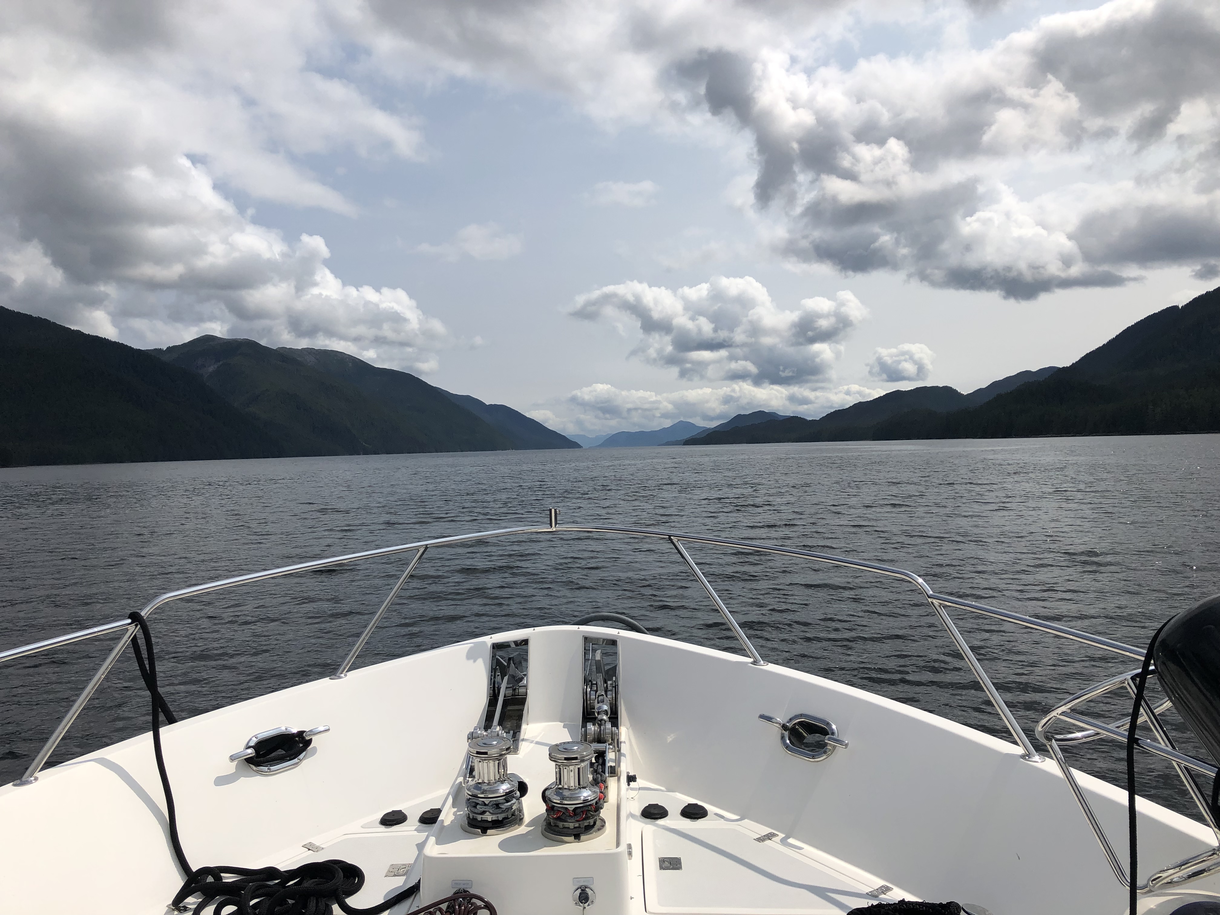
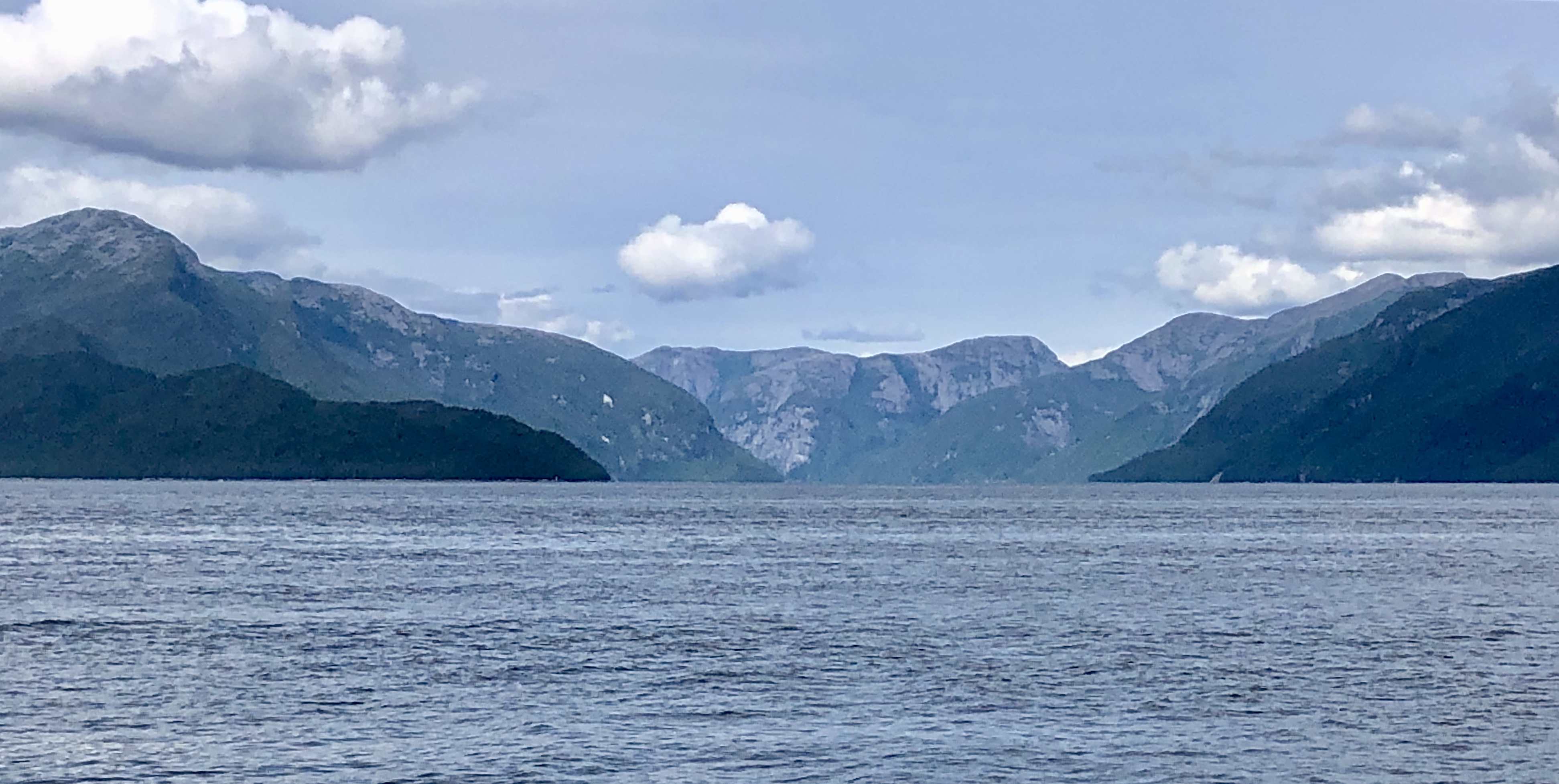
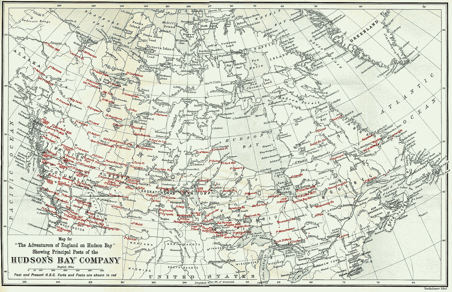
Sailing south through Tolmie Channel, we pass by Star Island, Needle Rock and Fish Island.  Like the water in Trout Bay, this channel is relatively shallow (between 32 and 80 feet) but as we merge with the wider Finlayson Channel our depth gauge shows the ocean bottom drops off quickly to an average 2000 to 3200 feet of water. Named after Roderick Finlayson, a Scotsman with the Hudson Bay Company who is considered the founder of Victoria, this channel is a major highway of the Inside Passage. This morning we are the only boat in any direction.

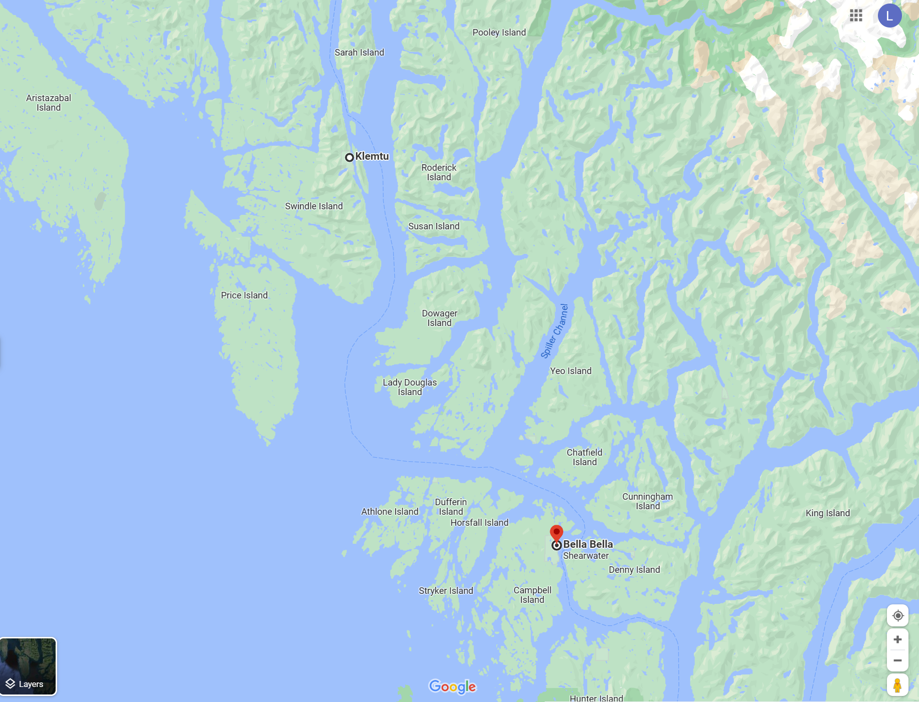
I have to smile when consulting our chart—a few more places with female names. We’ll be skirting Susan Island, Dowager Island, Suzette Bay, and Lady Douglas Island. To starboard sits Mount Sarah on Swindle Island while Mount Jane crests Dowager Island at 2372 feet.  There’s also Squaw Island, although its name might not pass muster today as politically correct.

Finlayson Channel empties into Milbanke Sound and here we encounter larger swells that have rolled in from Queen Charlotte Sound to the west.  To our east, the Fjordland Conservancy preserves a portion of these glacial fjords. Established in 1987, the park covers 189,838 acres and was the first on the North American continent to protect this type of environmental zone. Since there are no roads, the Park is mainly enjoyed by kayakers and sailors.

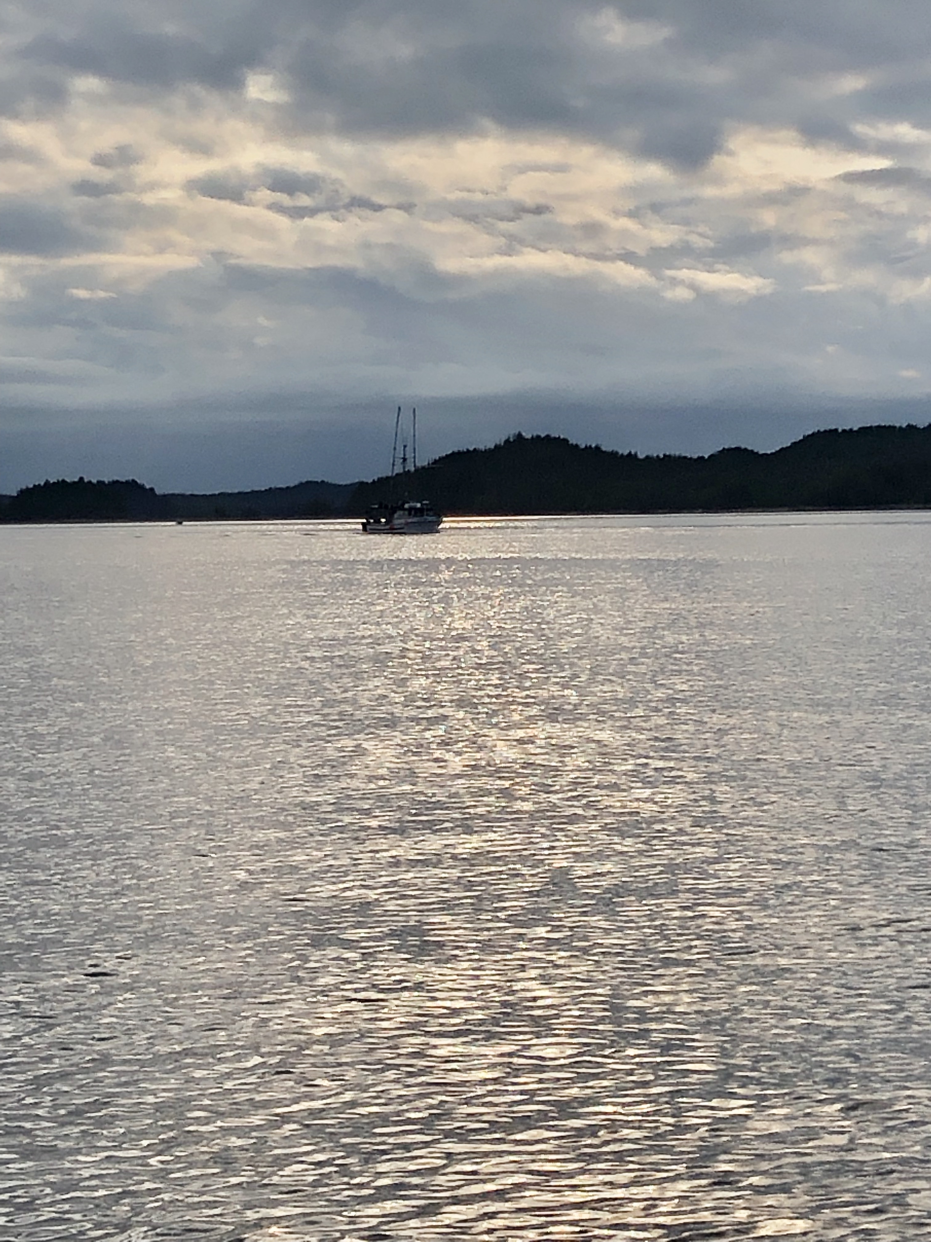
Chris is hoping we might sight whales in Milbanke Sound, named after Vice Admiral Mark Milbanke who commanded the British fleet at the Battle of Gibraltar in 1782. Certainly, there were abundant whales here when Vancouver and Cook explored these waters. Today, we spot only a few Dall’s porpoises, a common species in the northern Pacific, often mistaken for Orca whales. Dall’s porpoises have a wide hefty body, a comparatively tiny head, no distinguished beak and a small, triangular dorsal fin. Mostly black with white to grey patches on the flank and belly, they are the largest porpoise species, growing up to 7.5 feet in length and weighing between 370 and 490 pounds.

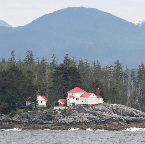
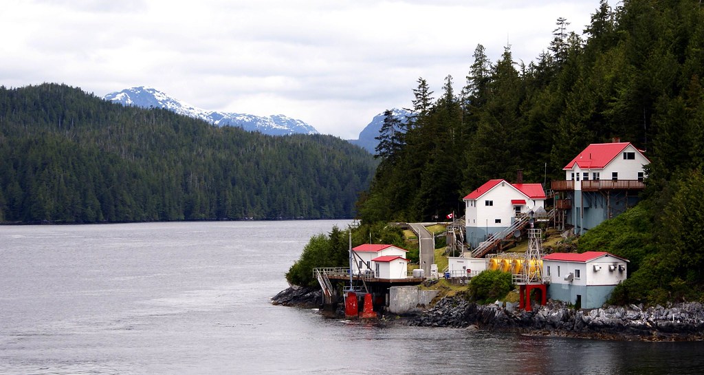
Our crossing of Milbanke Sound passes quickly and soon we spot the Ivory Island Lighthouse which marks the entrance to Seaforth Channel, our final “turn” enroute to Bella Bella. Constructed in 1898 on an exposed rock, this lighthouse has endured many brutal storms, tidal waves, and tsunamis. But perhaps the most romantic story belongs to Gordon Schweers who became the head lighthouse keeper in 1981.  He and Judy corresponded for nine months, before she left her family in California and headed north to marry a man she had never met and start a new life on this remote island. The kind of adventure story one might normally attribute to a woman in the 1880s, not the 1980s.

The first year on Ivory Island would test the couple’s mettle. On Christmas Eve 1982, nearby McInnes Island Lighthouse reported their barometer was 29.88 and falling rapidly. A winter storm had been buffeting the lighthouse station for about a week, and now the weather was getting worse.

Gordon and Judy were living in the main building which had been carefully built with seasoned fir and reinforced floors. Gordon reported that night “it was groaning in every rafter like an old barque” as gale force winds swept along the open ocean from Cape St. James to the station’s back door. The combination of wind and water made the kitchen windows “resemble a plastic sheet which was expanding under heat.”

The tide peaked early on Christmas morning when a wave surmounted the sea wall and flooded the station. Gordon later wrote the following description of that memorable Christmas Day:

“Our only indication that we were ‘over our heads’ came when the outer door to the radio room filled entirely with white sea water. For a second the door seemed to resist – then the dam burst, flooding sea water and debris into the kitchen pantry, basement, living room and cistern. Neither keeper was injured by flying glass, even though I had bare feet and fled the room while it was still awash. Andrew [the radio operator] followed abruptly, since the same wave in uprooting small trees and severing larger limbs had stripped the radio room roof bare of shingles. With an outer kitchen window shattered, we moved back into the safety of another room, but were again interrupted while ebbing the flow of water. There is no way of knowing whether the 32-foot metal tower was knocked down by the same wave or one succeeding it, yet the DCB 10 main light shone [its] search beam hard through the living room windows for several minutes before burning out. In the confusion I had briefly mistaken it to be the beam from a ship driven off course by the storm.”

Besides the dwelling, only the station’s radio antenna, braced by eight guide wires at the southeast corner of the point, remained standing. As adventuresome as I am, I doubt I would have stayed on this barren rock connected by only a footbridge to civilization on the adjacent Lady Dowager Island.

The importance of Ivory Island Lighthouse is evidenced by the fact it remains staffed today despite its dangerously exposed location.

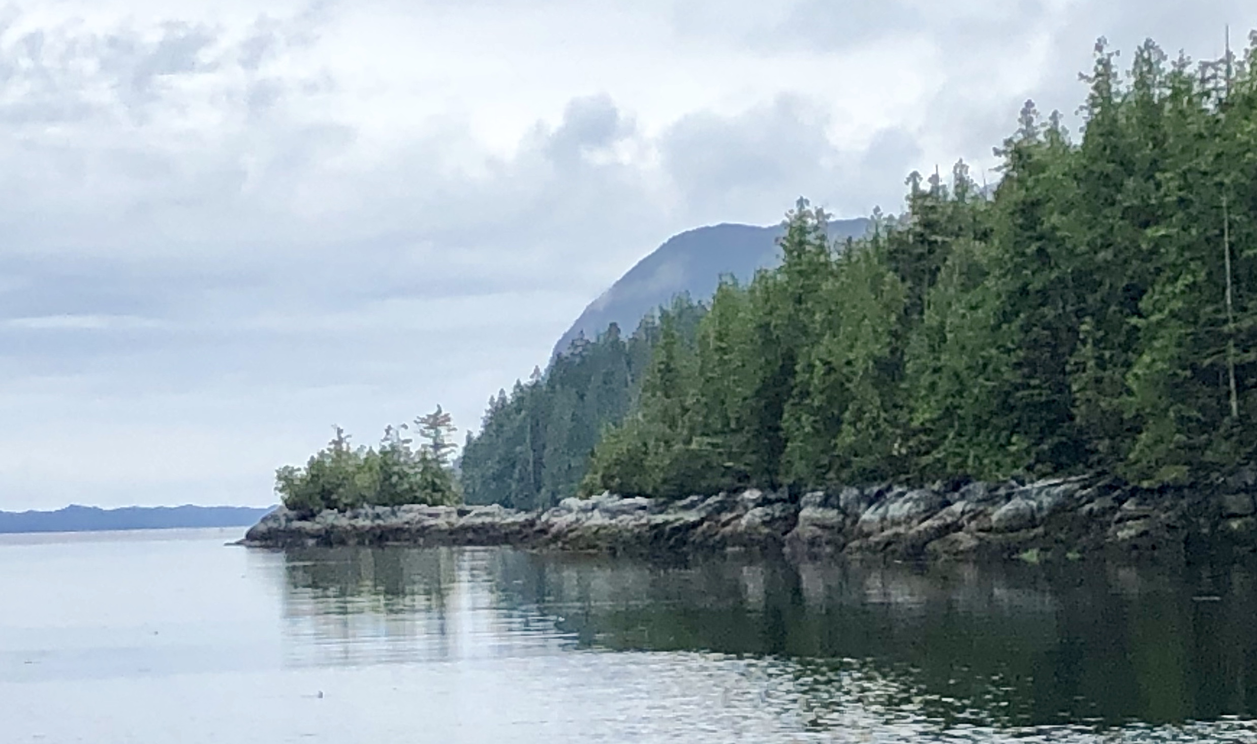
As we round the bend in Seaforth Channel, we are in the Lady Douglas-Don Peninsula Conservancy, comprising several coastal islands and an intricate mainland shoreline with numerous small bays, coves, passages and shoals. This conservancy protects the important Marbled Murrelet habitat. The Marbled Murrelet is a small North Pacific seabird and a member of the Auk family. While suspected of nesting in old-growth forests, it was not documented until 1974 when a tree-climber found a young chick in a nest, making it one of the last North American bird species to have its nest described. The Marbled Murrelet has declined in significant numbers since humans began widespread logging of its nest trees in the 1850s. Considered globally endangered, the bird has become a bellwether for the forest preservation movement.

We keep to the center channel as we pass Dearth Island and dozens of small islets where underwater rocks are a navigation hazard.  The beacon on Dryad Point marks our turn into the narrow entry to Bella Bella between Campbell Island and Saunders Island. Our depth gauge shows we go from 300 to 400 feet of water to 80 feet or less in a just a few hundred yards.

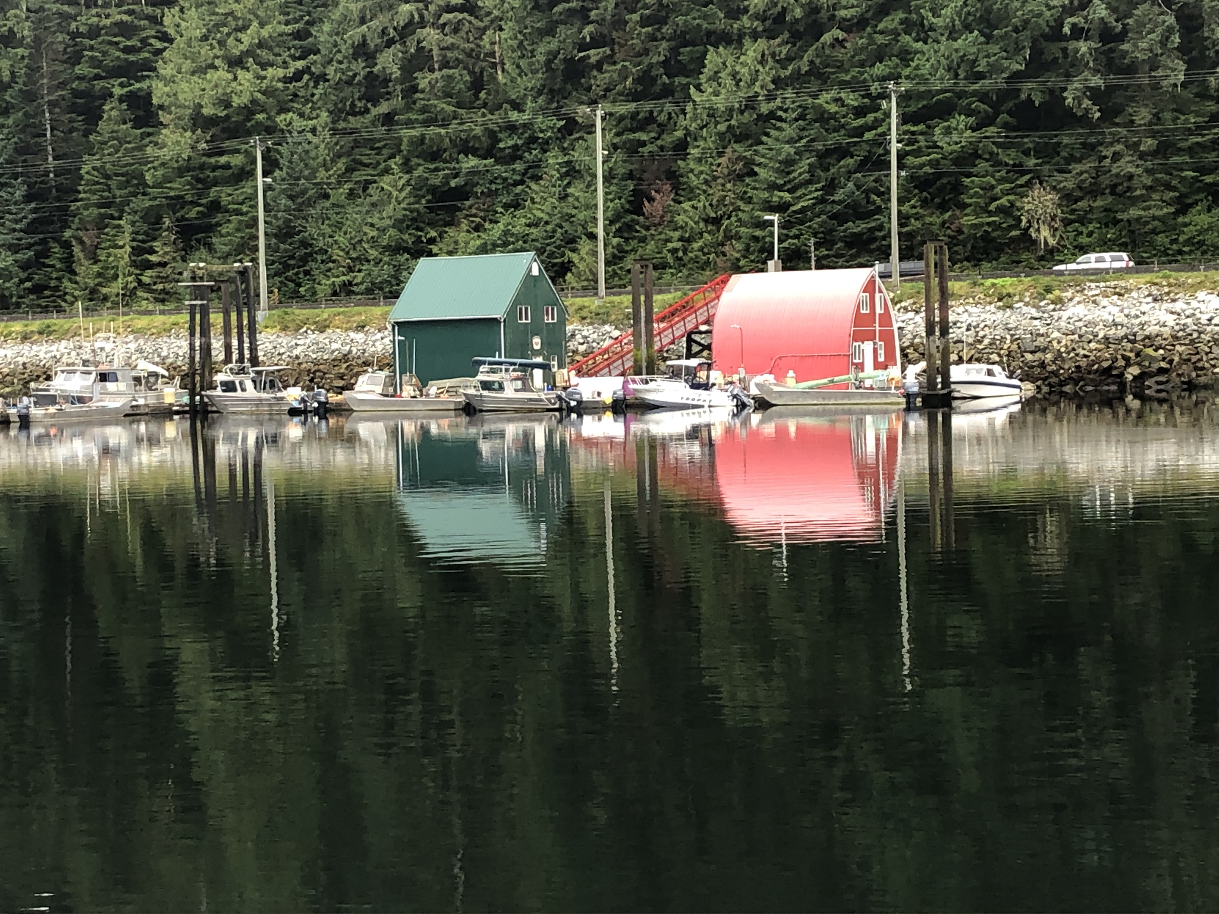
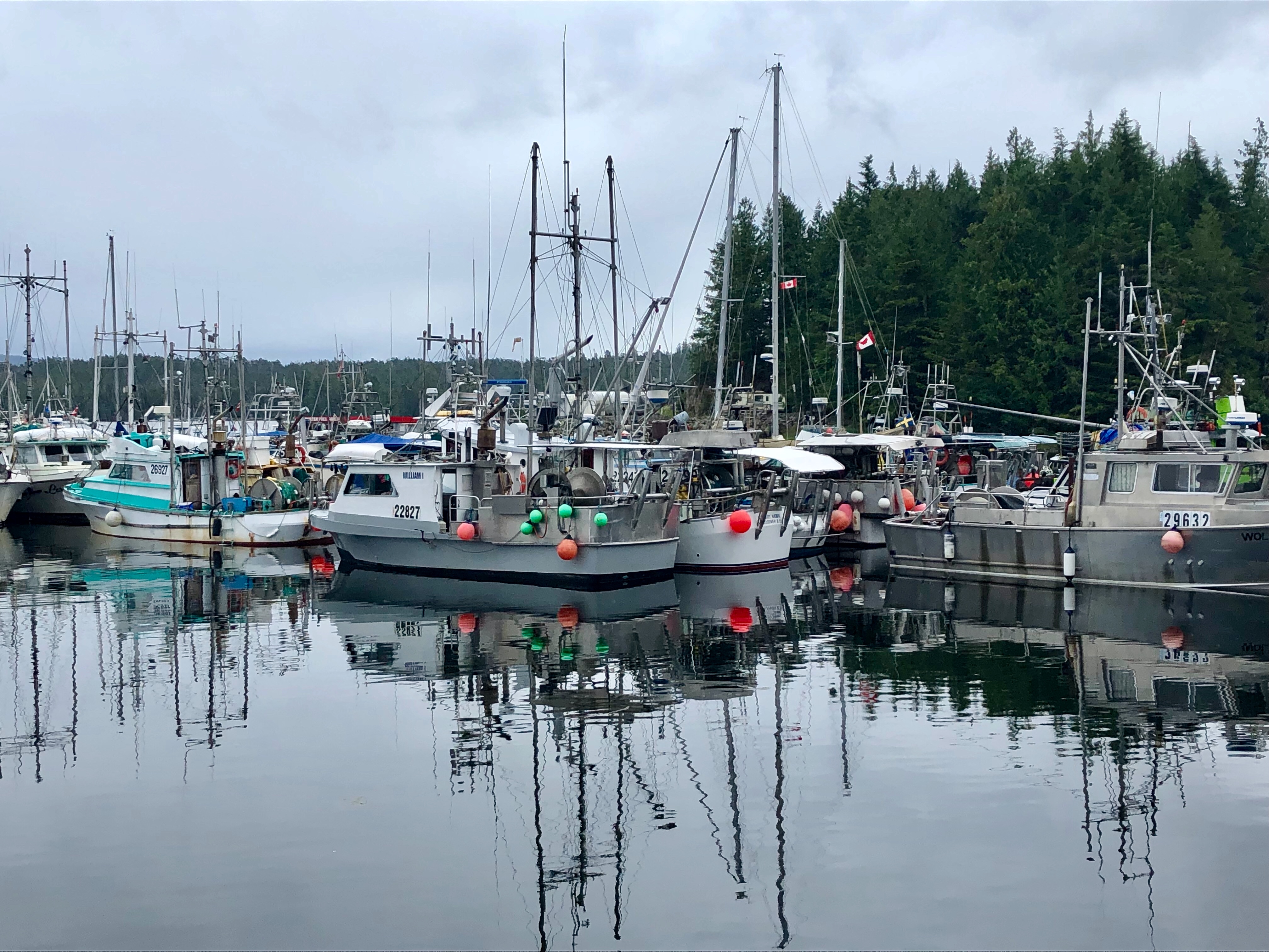
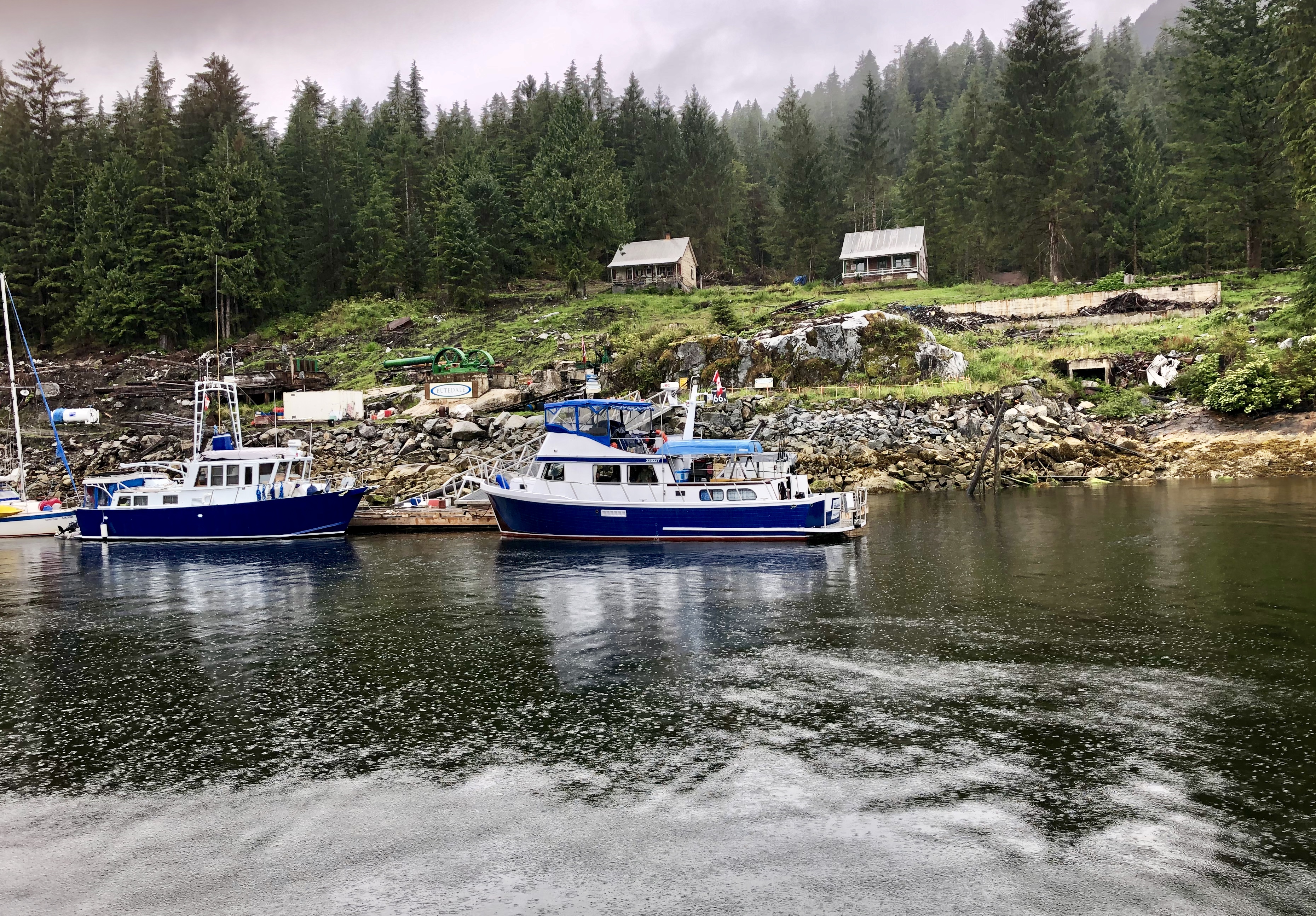
As we enter the Shear Water Marina, dozens of weathered commercial fishing boats with their distinctive winches and buoys line every dock. Commercial and recreational fishing in British Columbia is fiercely regulated: there are certain “Open Seasons” for different fish, daily limits, possession limits, and annual limits. The type of gear used is also specified. For example, fisherman can only use barbless hooks and lines for all varieties salmon; dip nets, ring nets and specific traps for crab; hook and line for halibut, sablefish and cod; and herring jigs, herring rakes, dip nets or cast nets for herring, sardines, anchovies, and mackerel.

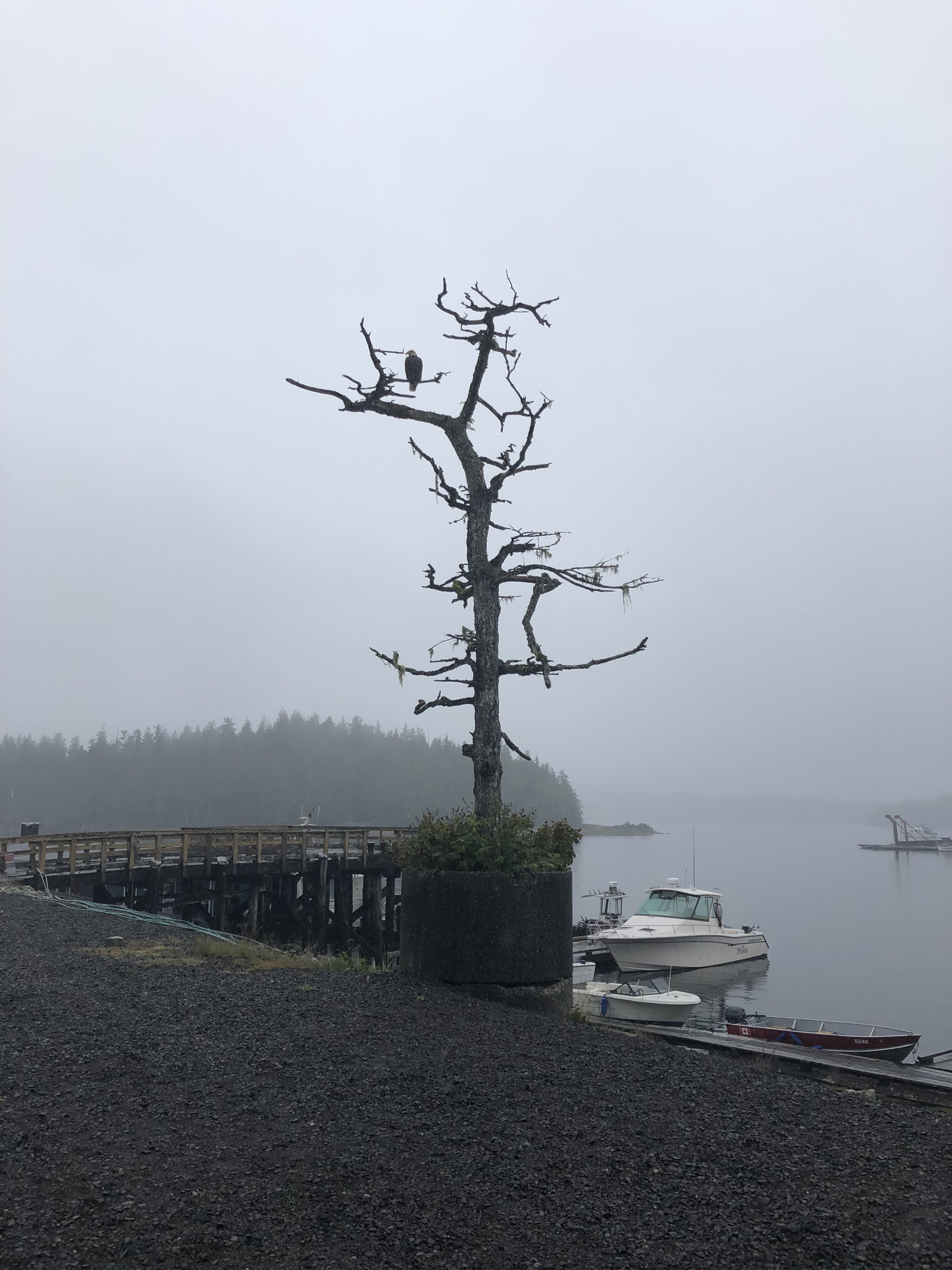
While it’s starting to rain, Chris wants to fill up at the fuel dock before we tie up for the evening since we have a very long run tomorrow.  Once snuggly in our slip at the dock, I take pictures of the majestic eagle standing guard on a nearby snag.

I savor this luxury of time where I can spend the evening reading in the enclosed pilot house while listening to rain on the roof.

© Copyright 2012-2023. Lisa Scattaregia. All rights reserved.

Inside Passage — Prince Rupert to Klemtu — July 29, 2019

At 7:20 AM, the smell of freshly baked muffins greets us at Cowpuccino’s, the sole coffee shop in town. A makeshift directional sign points to Rome 5431 miles to the east and to Tokyo 4428 miles to the west. Another marker on the pole shows the Alaska border is now 26 miles north. We’re in the land of the “Mounties” — the Royal Canadian Mounted Police.

One of my favorite movies as a child was “Susannah of the Mounties” with Shirley Temple. Shirley, the orphaned survivor of an Indian attack in the Canadian West, is rescued by a handsome Canadian Mountie and his plucky girlfriend. True to the predictable plot of all her films, little heroine Shirley saves the day by charming the tribe’s Chief into a peace treaty with the settlers. The real hardships of early pioneers in this corner of the continent were not so easily overcome.

Established in 1873, the Royal Canadian Mounted Police (RCMP) have jurisdiction as peace officers in all provinces and territories of Canada. In addition, the service provides police services under contract to eight of Canada’s provinces (except Ontario and Quebec), all three of Canada’s territories, more than 150 municipalities, and 600 Indigenous communities. The RCMP is also responsible for border control, and we have filed our Port of Entry paperwork with the local harbormaster.

Sunbreaks illuminate the ridge tops as we gently pull away from the dock and head south past Lelu Island, an old Chinook name for “wolf.”  In fact, coastal wolves inhabit many of these islands.  Unlike mainland wolves that hunt abundant deer, mountain goats, and moose in the forests of British Columbia and Alaska, coastal wolves swim between the islands in search of spawning salmon, harbor seals, and sea otters. 

My friend interrupts my reverie to point out the Lawyer Islands ahead to port, bordered by Client Reefs and Bribery Islet. We wonder about who might have named them and the story behind the humorous names.

For the next hour, the water is flat calm as we pass a dozen more small, forested islands and outcroppings along Arthur Passage—verdant green stands of pine with no houses, no telephone poles, no cell towers.

We are in the heart of the Great Bear Rainforest, roughly 16 million acres, one of the largest remaining tracts of unspoiled temperate rainforest left in the world. The area is home to grizzly bears, cougars, wolves, salmon, and the Kermode or “spirit bear,” a unique subspecies of black bear. One in ten cubs displays a recessive, white-colored coat!

The forest features 1,000-year-old Western red cedar and 300-foot-high Sitka spruce. Coastal temperate rainforests are characterized by their proximity to both ocean and mountains. Abundant rainfall results when the atmospheric flow of moist air off the ocean collides with mountain ranges. In 2016, the Canadian government agreed to permanently protect 85-percent of this primordial forest from logging. On the western coast of Vancouver Island is another protected rainforest—the Pacific Rim National Reserve near Tofino. We had hiked the trails there when our son was only eight years old. When we lived in Sequim, we often trekked the moss-laden rainforest trails in the Olympic National Park. And I wonder–why is it so difficult to protect 100-percent of these fragile ecosystems?

According to our chart, the large island to our starboard side in Grenville Channel was named after William Pitt by Captain George Vancouver during his explorations in 1793. Pitt was only 24 in 1793 when he became Prime Minister of Great Britain, a post he would hold intermittently for the next 20 years (he’s still the youngest PM in Britain’s history). Of course, Fort Pitt and my hometown of Pittsburgh were also named after this man who died when he was just 47.  Perhaps as unfathomable for Pitt to imagine dozens of places in the New World named in his honor, as it was for a small girl from Pittsburgh to imagine sailing these pristine waters on a private yacht.

Described by a coast pilot account written in 1891: “In Grenville Channel, the land on both sides is high, varying from 1500 to 3500 feet and as a rule densely wooded with pine and cedar.  The mountains rise almost perpendicular from the water and cause the southern portion of this narrow channel to appear even narrower than it is. But the general effect of so many mountains rising one behind the other renders the Grenville Channel one of the most beautiful landscapes in these waters.”

As we pass Stuart Anchorage, I seem surrounded by history I’ve researched and written about in magazine articles. Captain Charles Edward Stuart was the last Commander in charge of the Hudson Bay Company’s trading post at Nanaimo before it closed in 1859.  Some seventy years earlier, Captain James Cook on his third voyage of discovery along the coast of British Columbia traded a few muskets for thick beaver pelts.  Although Cook was murdered by islanders when his ship wintered in the Sandwich Islands (Hawaii), those beaver furs would create a sensation once his ship the Resolution arrived in Peking harbor. A few lush beaver pelts from the forests of Vancouver Island would spawn the Silk Road trade route, the Hudson Bay Company, John Jacob Astor’s American Fur Company, the explorations of Lewis & Clark in search of an inland route for spices and silks from China, and the early settlement of the Pacific Northwest. 

Sadly, today you will not find beavers in the forests along this fjord – a natural resource trapped to extinction.  The fur trappers were followed by loggers who also plundered the riches in this part of the world.  Thick stands of cedar and fir trees that carpet the mountainsides in all directions are largely second growth—many majestic and irreplaceable old growth Western red cedars and Sitka spruce along this coast disappeared more than 150 years ago.

We have been traveling in awe through this still wild place, the forested hillsides interspersed by waterfalls that cascade down from high mountain lakes. We’ve not seen any sign of man, no cabins, no settlements and only two boats in the last four hours. A landscape where one can still breathe deeply.

We skirt Princess Royal Island along the Fraser Reach, named after Donald Fraser, a native of Scotland and businessman in Victoria in the 1860s. Fraser promoted steamers through the isthmus of Panama as a faster way between the British colony and Europe than the arduous journey around Cape Horn and South America. 

Captain Vancouver anchored his ship Discovery near these islands in June 1793. He recorded that the weather was foul and the fishing terrible.

Our weather is also overcast and cold as we search for anchorage for the night at an abandoned cannery near Butedale Falls. When we arrive, it’s raining hard, and the small floating dock is already crowded.  Chris determines it’s too deep to anchor so we continue south past the iconic Boat Bluff Lighthouse on Sarah Island.

Originally established in 1907, the Boat Bluff Lighthouse was built during the fifth phase of lighthouse construction on British Columbia’s coast. Lightkeepers are the only residents of the island, and the picturesque station is a well-known landmark to vessels which must pass closely in order to navigate the very narrow Tolmie Channel. 

Both Sarah Island and nearby Jane Island were named after the daughters of John Work (nee John Wark in County Donegal, Ireland), an officer of the Hudson Bay Company (HBC) instrumental in the expansion of the fur trade and establishment of HBC outposts in the Northwest.  

Work who had 10 children began a series of 15 remarkably observant and informative journals of his field trips in the Pacific Northwest from July 1823 to October 1835. Crossing inland from Calgary via the Athabasca River and Athabasca Pass, the party reached the HBC Boat Encampment at the big bend of the Columbia River. This was the major fur trade route from the interior of British Columbia and the areas around present-day Banff and Jasper National Parks.  He helped extend the river trade into the Flathead country in Montana and later traveled with colony Governor George Simpson to the headquarters of the HBC district at Fort George in Astoria, Oregon.

Work also accompanied an expedition under Chief Trader James McMillan sent by Governor Simpson to explore the lower reaches of the Fraser River for the purpose of locating a site for a major post. Simpson was convinced the British could not retain control of the south bank of the Columbia River. On the return trip in December 1824, McMillan and Work discovered the Cowlitz Portage, which became an important link between the Columbia River and Puget Sound. In the spring of 1825, Work helped move the headquarters from Fort George to the newly established Fort Vancouver on the north side of the river (now in Washington State).

Governor Simpson then assigned Work as head of Spokane House with instructions to establish a new and better located post on the Columbia at Kettle Falls which became Fort Colville. Work took pride in the success of the Fort’s farm which helped to make the district independent of expensive imported provisions. He also conducted trading expeditions and procured horses along the Snake River for the company’s brigades at New Caledonia (British Columbia) and Fort Vancouver. Work often accompanied the fur returns from New Caledonia and his own district to the lower Columbia River to Astoria where they would be loaded onto steamers bound for China.

In August 1830, Work became Peter Skene Ogden’s successor in charge of the Snake Country brigade. Between August 1830 and July 1831, he travelled some 2,000 miles into what is now eastern Idaho, northwestern Utah, and the Humboldt River in Nevada. The returns of the expedition were profitable but still disappointing. Work went into the Salmon River (Idaho) and Flathead country in 1831–32. The rugged terrain and marauding Blackfeet made the expedition difficult, and the returns were not great, partly because of growing competition from the Americans. In his report for 1832, Governor Simpson recommended that the Hudson Bay Company withdraw from the Snake Country.

In September 1832, Work was assigned to the Bonaventura Valley (Sacramento) in Mexican California. Trapping in the valley was not favorable because of established American trappers and Native American hostilities, forcing Work and Laframboise to join forces in an exploration of the coast from San Francisco to Cape Mendocino. Disappointed in the hunt (an estimated 1023 beaver and otter skins), Work returned to Fort Vancouver in October 1833.

In December 1834, Work succeeded Ogden in charge of the coast trade at Fort Simpson, B.C. on McLoughlin Bay. He sailed north on the HBC brig Lama and supervised the construction of Fort Simpson. He also traded along the northern coast of New Caledonia, on northern Vancouver Island, and the Queen Charlotte Islands, always with keen competition from American coastal traders.

In January 1836 he was back in Fort Simpson, his permanent residence for the next decade. In his journal, he wrote that the natives were “numerous, treacherous . . . and ferocious in the extreme.” Frequently away supervising the trade, he usually accompanied the pelt returns to the Columbia River in the fall. To economize on imported foodstuffs, Work established a garden at Fort Simpson, and in 1839 he assisted in surveying Cowlitz Farm for the Puget Sound Agricultural Company, a subsidiary of the HBC supplying provisions to the Russians at Sitka (Alaska).

Although Work had often expressed his desire to find “a corner of the Civilized World in quietness,” concern for the cultural duality of his family led him to settle permanently at Fort Victoria (he had married Josette Legacé, a Spokane woman of mixed blood). In August 1852 he purchased 823 acres of farmland on the northern outskirts of Victoria and built a mansion, Hillside. By 1859, he owned over 1800 acres, the largest land holder on Vancouver Island.

Comfortably perched in the comfy banquette in the pilot house, I’ve been distracted by historical research into the men who attempted to tame this wilderness and realize it’s getting dark. Chris needs my help readying the fenders as we approach Cone Island which protects the tricky entrance to Klemtu.  The island derives its name from Bell Peak, a conical mountain also known as “China Hat” after hats worn by early Chinese immigrants who worked in the canneries and mines here.

Klemtu is a tiny village on Trout Bay; the few slips at the marina are already full. We’ll need to anchor, and Chris carefully consults the charts to ensure situating the yacht so we won’t be high and dry when the tide changes. A delicate maneuver to set the forward and aft anchors after which we shut down the engines, turn off the running lights, and switch on our anchor light.

The water is an inky glass mirror, a million stars dust the sky, and we float only a few hundred yards from the Klemtu Longhouse on the rocky promontory. As we sit outside on the flybridge, enjoying a light supper and glass of wine, I can easily imagine this quiet cove rimmed with the totem poles and longhouses of hundreds of years ago.

© Copyright 2012-2023. Lisa Scattaregia. All rights reserved.

Website Built with WordPress.com.

Up ↑