The Inside Passage – Bella Bella to Port McNeill – July 31, 2019

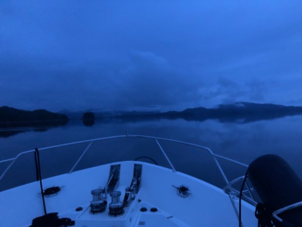
The hum of our generator wakes me.  I can hear Chris making coffee and he’s already pulled in our shore power cord and the two spring lines.  I climb down from the snug bed in the forward V-berth and pull on a turtleneck, pair of leggings and fleece sweatshirt.  It’s still pitch black, but our last leg in this amazing journey will take twelve hours or more so he’s getting the boat ready to leave just before first light. Dew still clings to our deck and windows, so I grab a cup of coffee and head up to the pilot house. 

Although a frequent stop for refueling and provisions for small boats and fisherman, Bella Bella remains a frontier town. In 1876, a Canadian reporter for the Toronto Globe described the settlement at Bella Bella: “The Indian houses situated on the very edge of the water were built of roughly hewn cedar planks about 15 or 18 feet square. The planks are made by splitting cedars which have grown to an enormous size and smoothing them after a fashion. Posts are stuck in the ground and the planks are nailed around them.  A plank bark covered roof is then put on with an aperture in the centre for the escape of smoke. Round the enclosure in several different corners were small rooms which were doubtless the dormitories of the commingled families. In the centre of the main floor a fire smoldered, over its smoke hung lines of dried salmon and other fish, together with berries, skins, bark or any other article of household use that required drying or seasoning. Round the common chamber, squatting on the packed mud floor, were women smoking their pipes and busily engaged in making baskets and mats.  They seemed quite content to be visited and the elderly ones made light and amusing jests at our expense.  In every house, there was at least one slumbering papoose and an endless variety of dogs.  There was a very ancient and fish-like smell about these dwellings…”

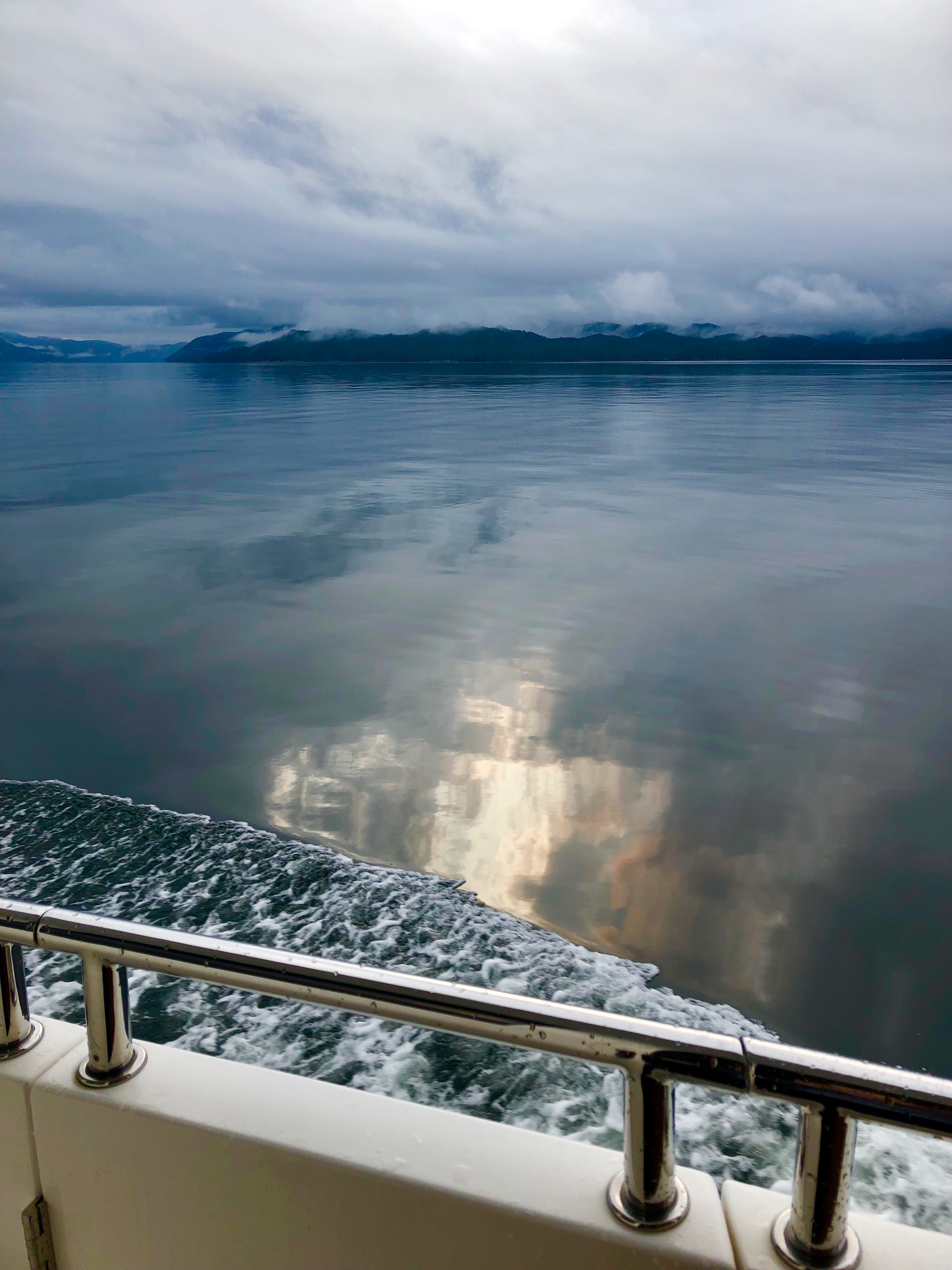
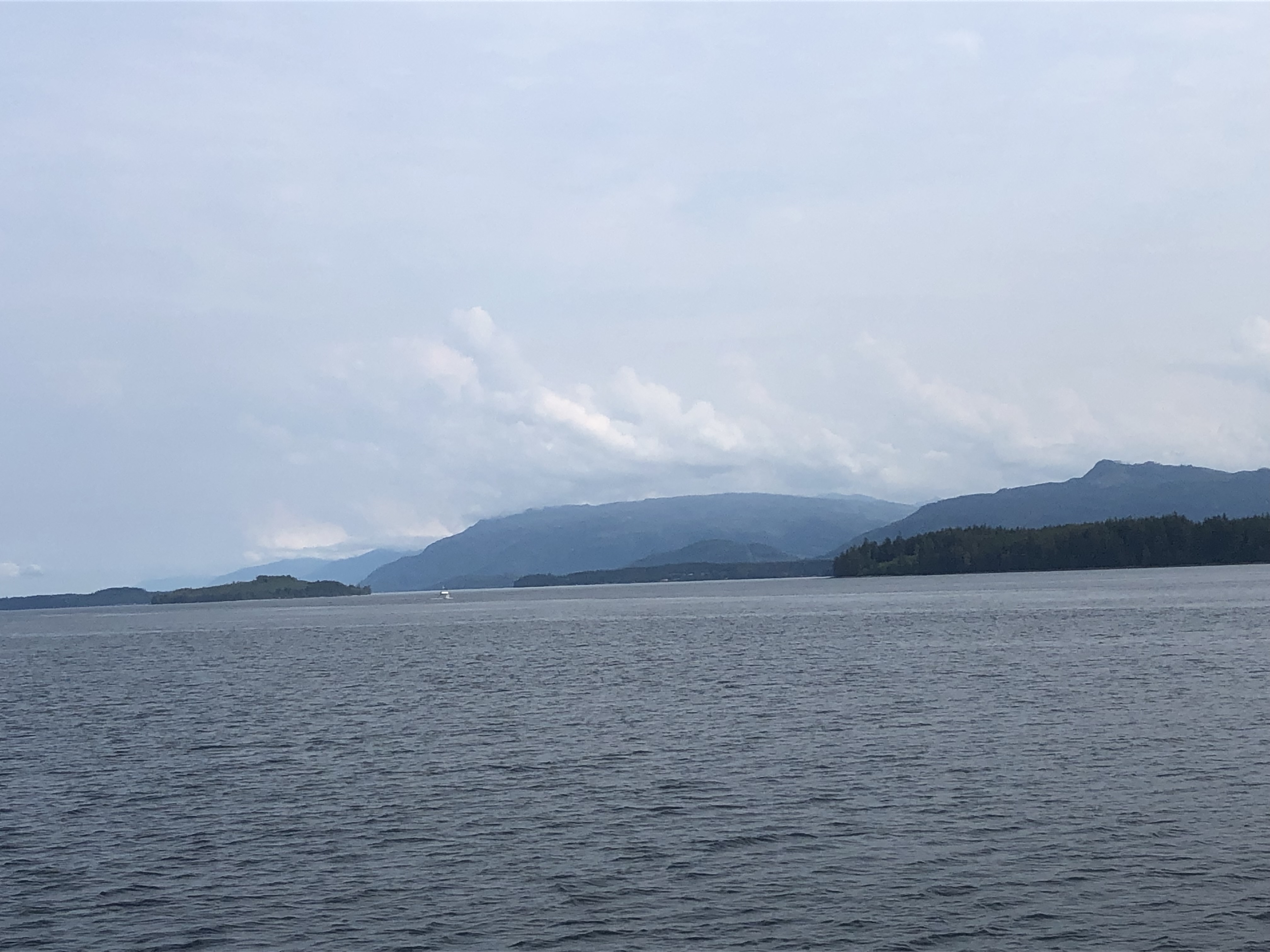
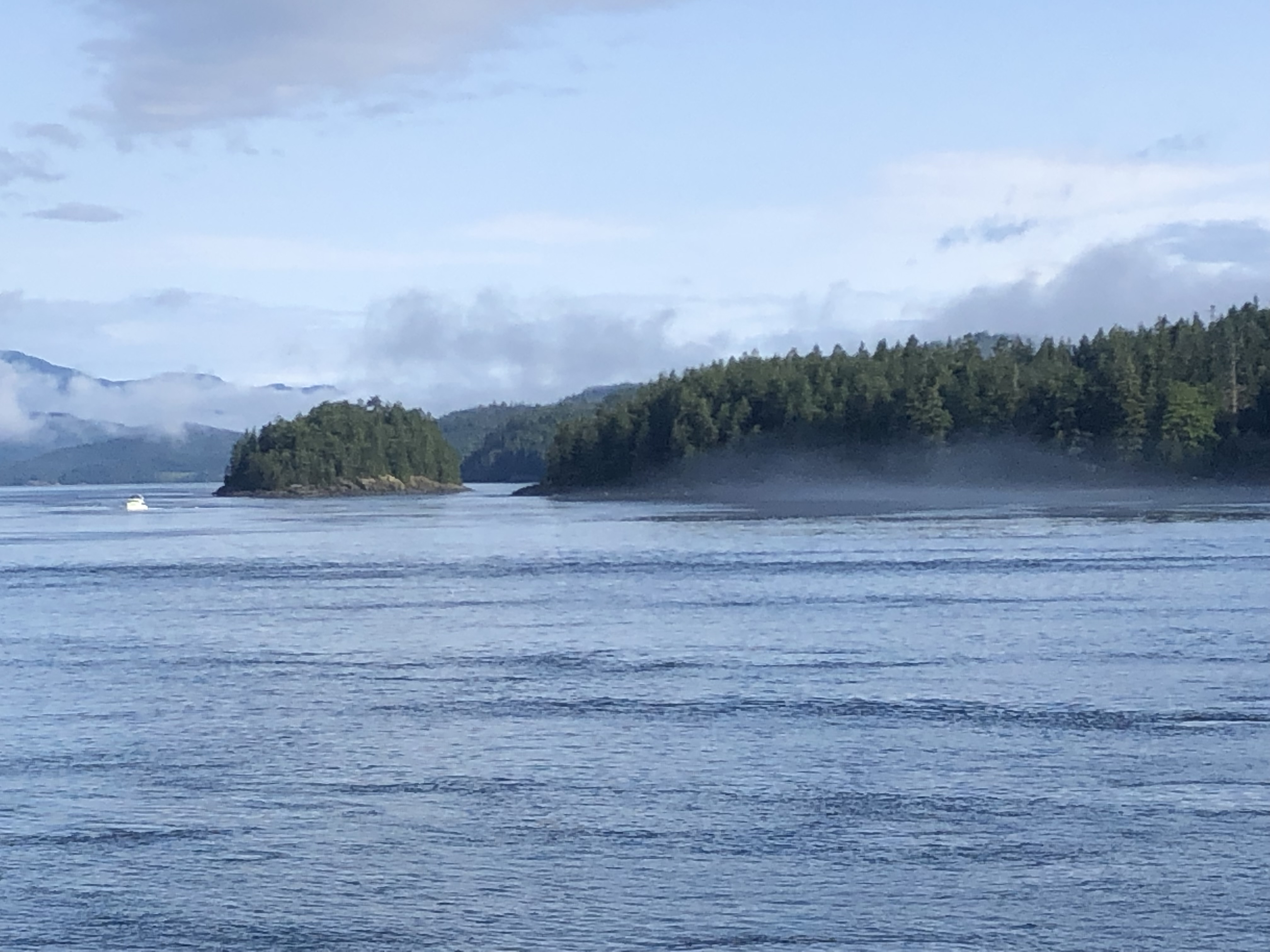
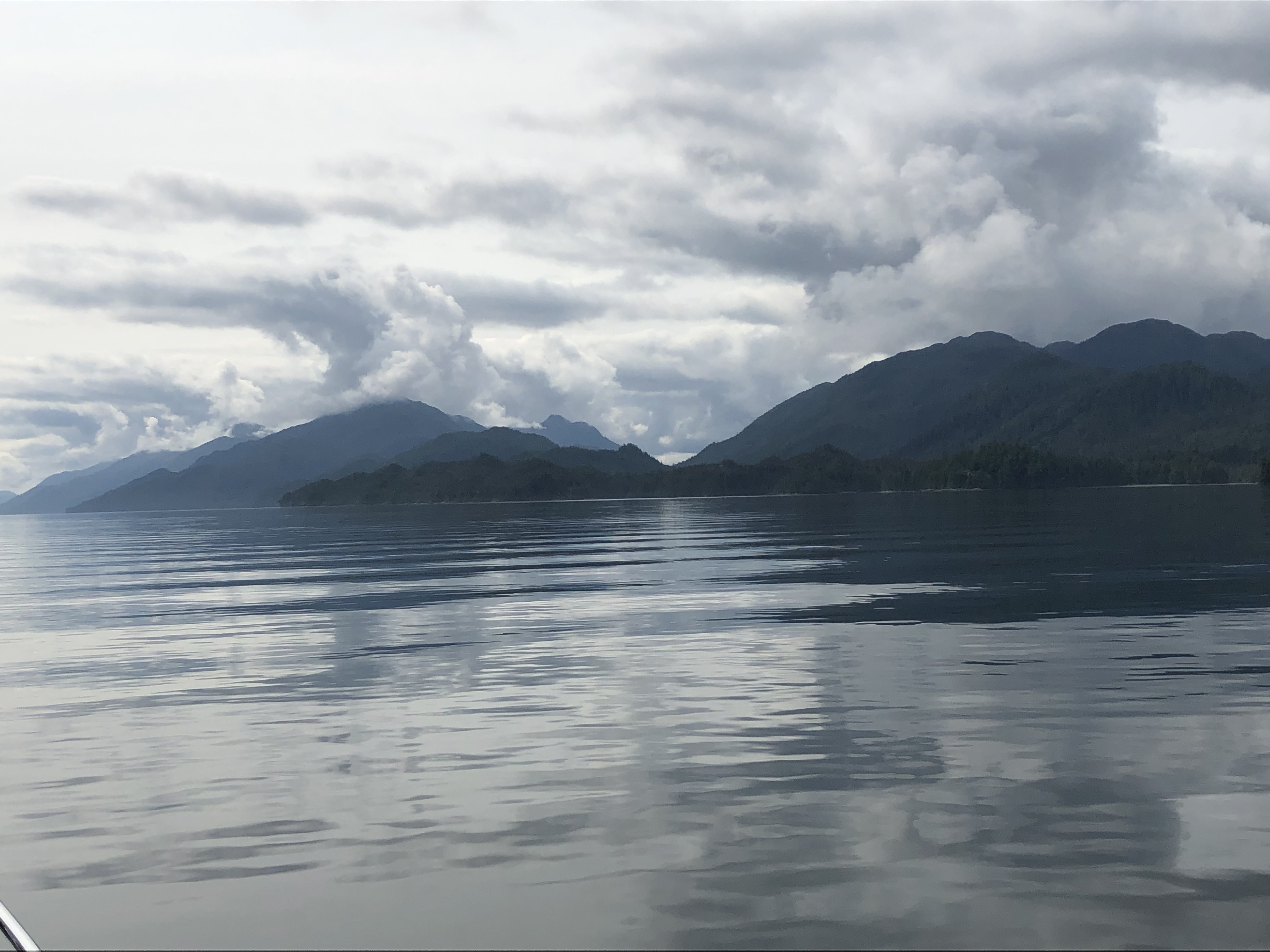
As we leave civilization behind, the water is a gray silk mirror.  We thread the narrow channel between Denny Island and Campbell Island, then skirt the north side of Hunter Island.  Sailing down its eastern shore, the channel widens along Nalu Island and Hecate Island.   The fog and rain only add to the beauty of this place.

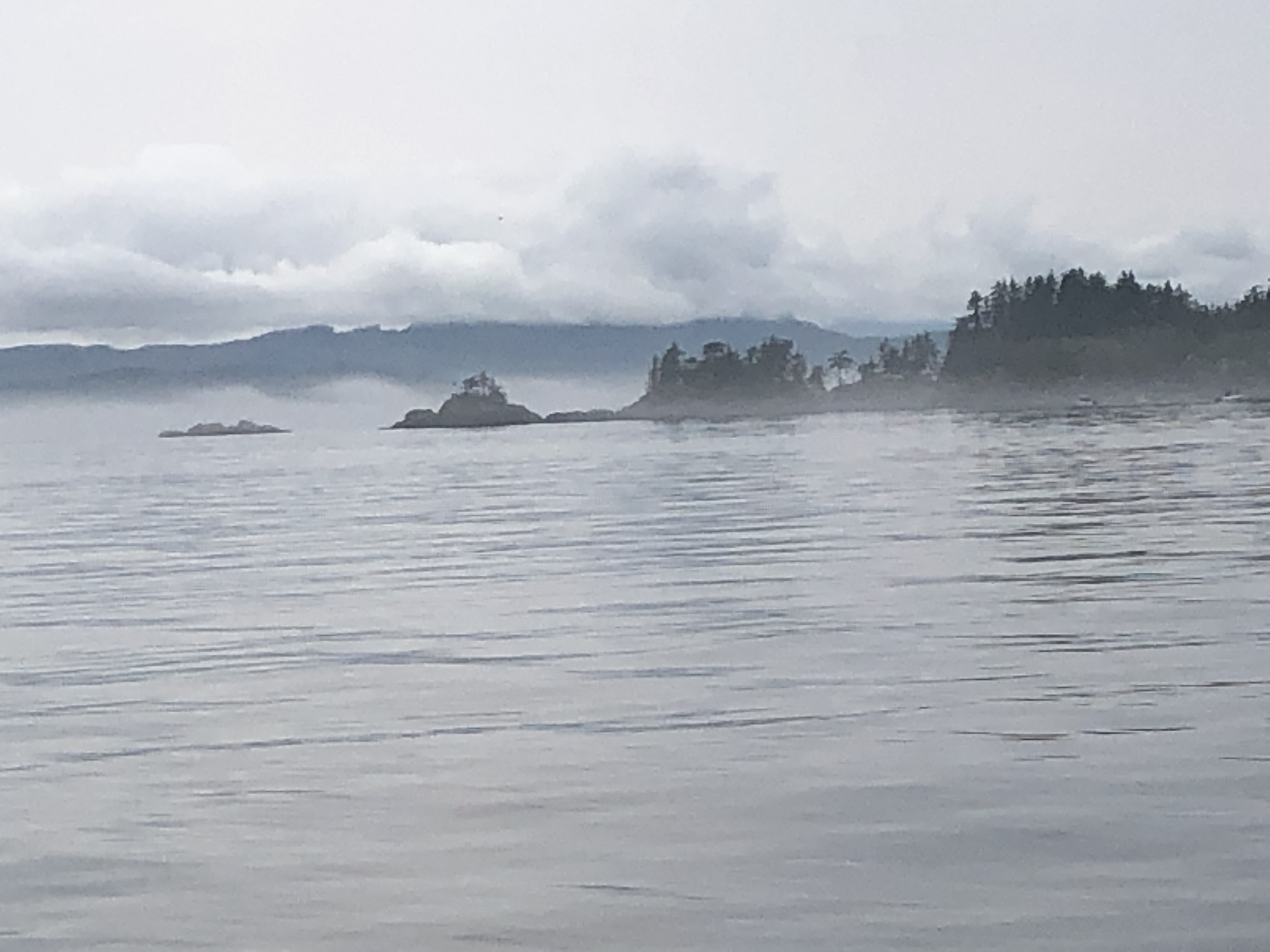
In 1987, British Columbia established the Hakai Protection Area to safeguard the marine and wildlife in the Hunter Islands archipelago, as well as the beautiful, long, sandy beaches on Calvert Island. Orca, humpback and grey whales, porpoises, dolphins, sea lions and river otters flourish here. The intertidal zone hosts a wide variety of mollusks, crabs, starfish, anemones, and sea urchins. On the islands of the Hakai, you’ll find black bears, wolves, black-tailed deer, and mink.  Chinook, Coho, Sockeye, Chum and Pink salmon all swim through here on their way back to mainland rivers and streams. Halibut, lingcod and rock cod are common.  More than 100 species of birds have been spotted in this rich environment: bald eagles, kingfishers, osprey, cormorants, sandpipers, loons, gulls, auklets, murrelets, oystercatchers, even black and ruddy turnstones.

Here we enter Fitz Hugh Sound where the ghost town of Namu lies to our west. At one time, Namu had a population of 400 cannery workers, office personnel and their families. The cannery was started in 1893, followed by a sawmill in 1909 to provide lumber for the cases of salmon.  As with most canneries at the turn of the century, labor, working hours and housing were segregated into groups of First Nation natives, Japanese, Chinese, and Caucasians. The British Columbia Packers Ltd, the largest fishing and fish processing company in B.C., took over operations in 1928. By 1970, structures included several two-story bunkhouses, dozens of family cottages, recreation and mess halls, along with the fish processing facilities, an electric power plant, and a large pier—all connected by a maze of boardwalks.

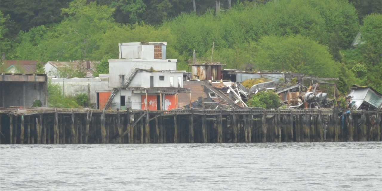
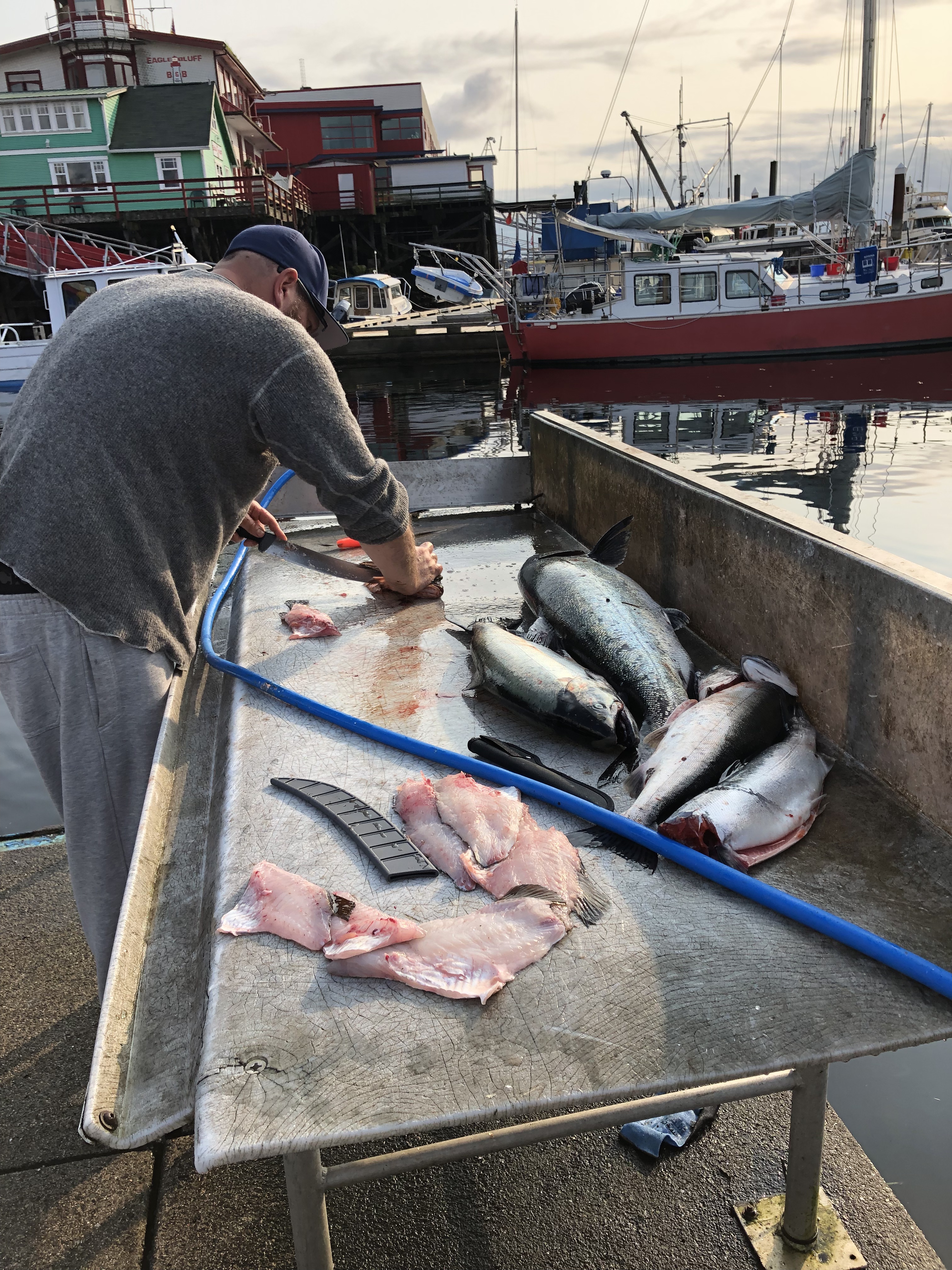
In the 1990s, declining fish stocks and improved refrigeration on fishing boats eventually forced BC Packers Inc. to sell the facility. Purchased by a developer with plans to build a sportfishing resort, the idea was later abandoned. Many of the original buildings were torn down or lost to fires; however, the large fish processing facility, pier and a few homes that remain are slowly rotting away. There are dozens of these abandoned canneries along the Inside Passage—something that makes the daily bounty of fresh frozen fish displayed in the glass case at my local grocery store seem all the more miraculous.

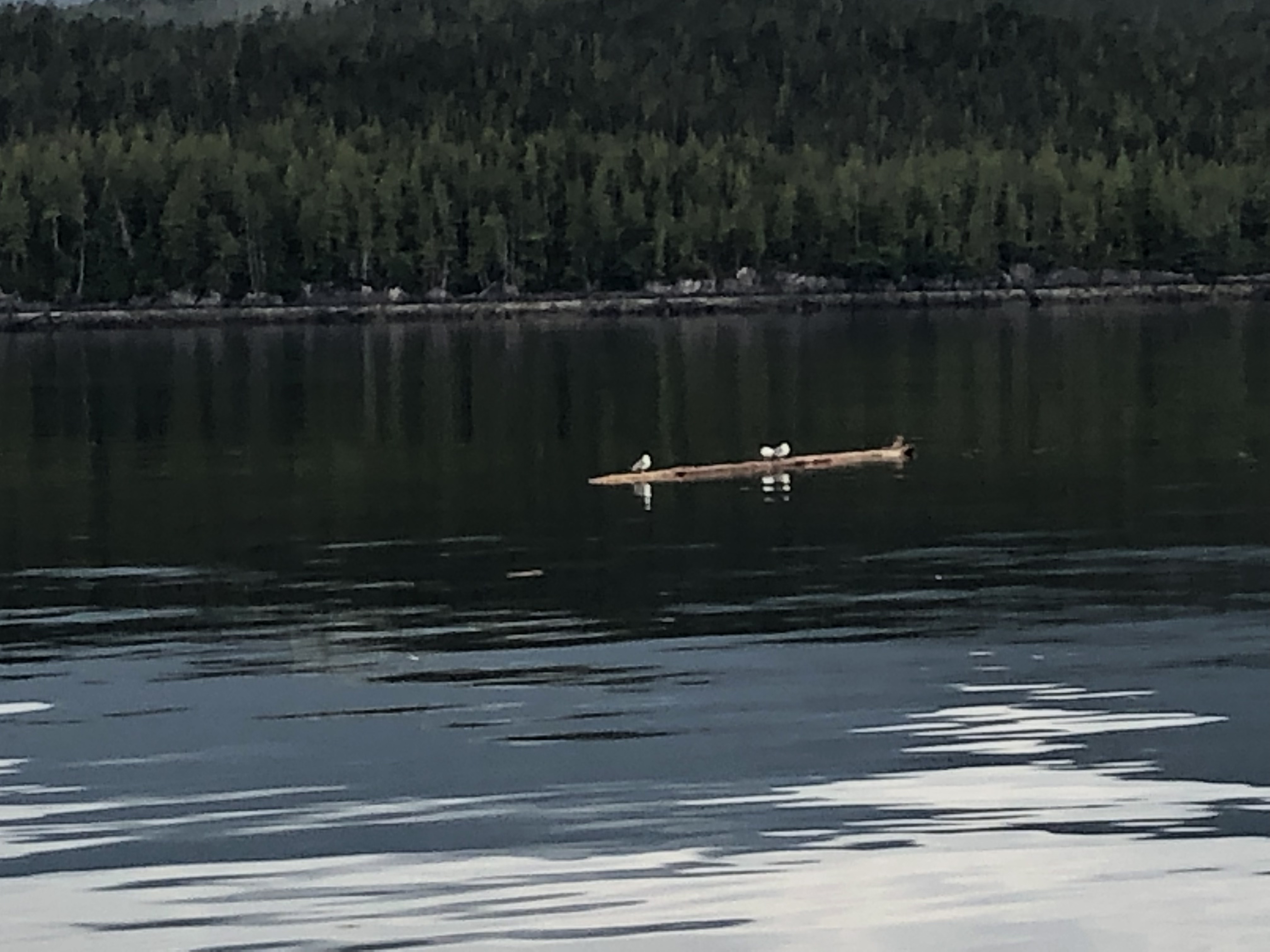
The water is an evergreen color this morning and a row of sea gulls on a floating log looks more like an impressionist’s painting.

Queen Charlotte Strait between Vancouver Island and the mainland of British Columbia connects Queen Charlotte Sound with Johnstone Strait to Discovery Passage, the Strait of Georgia and eventually Puget Sound—an important link in the Inside Passage from Seattle to Alaska used by the men who sought their fortunes in the Klondike gold fields a century ago.

The swells are gentle as we enter the open water of Queen Charlotte Sound and we use binoculars to view a few whale spouts in the distance – most likely Orca whales off to their favorite hunting grounds for seals in the Queen Charlotte Islands offshore.

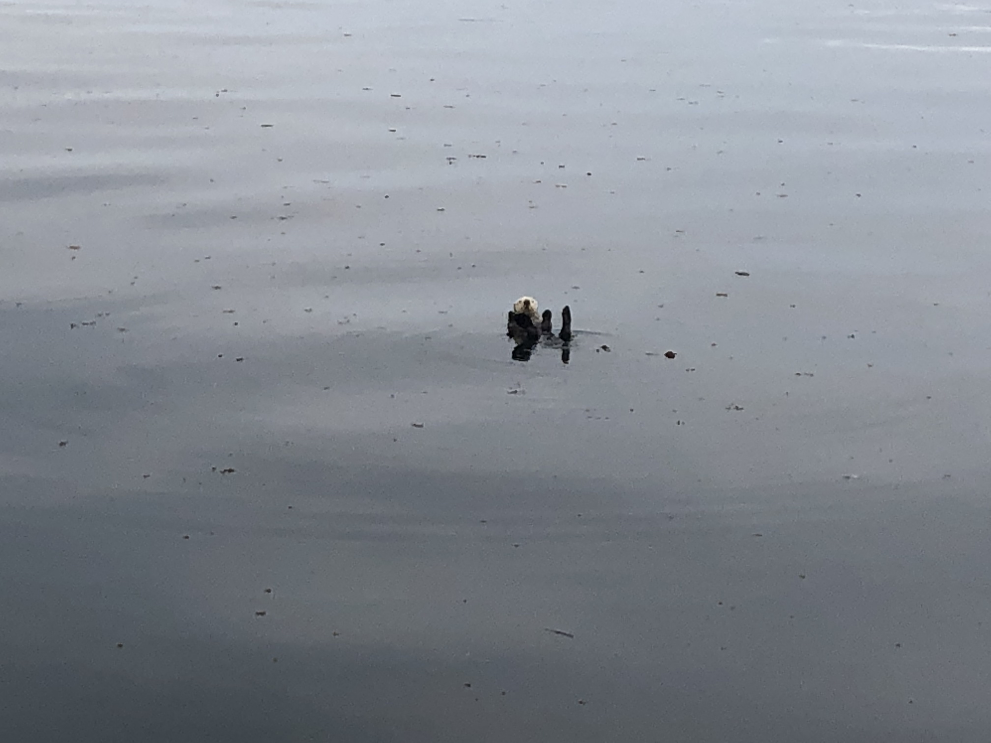
I photograph a family of playful sea otters in the kelp beds, but we are both surprised not to spy more wildlife this afternoon.

As we enter Johnstone Strait at the northern most tip of Vancouver Island, miraculously the clouds and fog begin to lift.

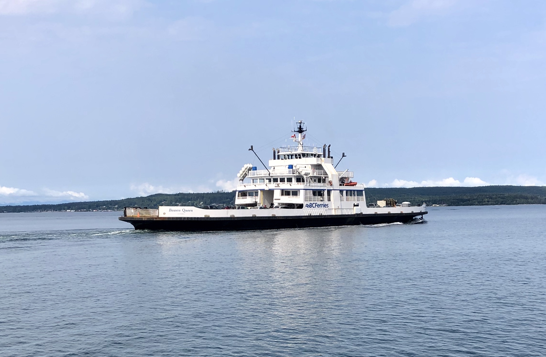
An hour later, we pass a BC Ferry bound for Port Hardy. Port McNeill, sheltered by Malcolm Island, was originally a base camp for loggers and didn’t become a settlement until 1936. Not surprisingly, another town named after a Captain in the Hudson Bay Company (William McNeill).

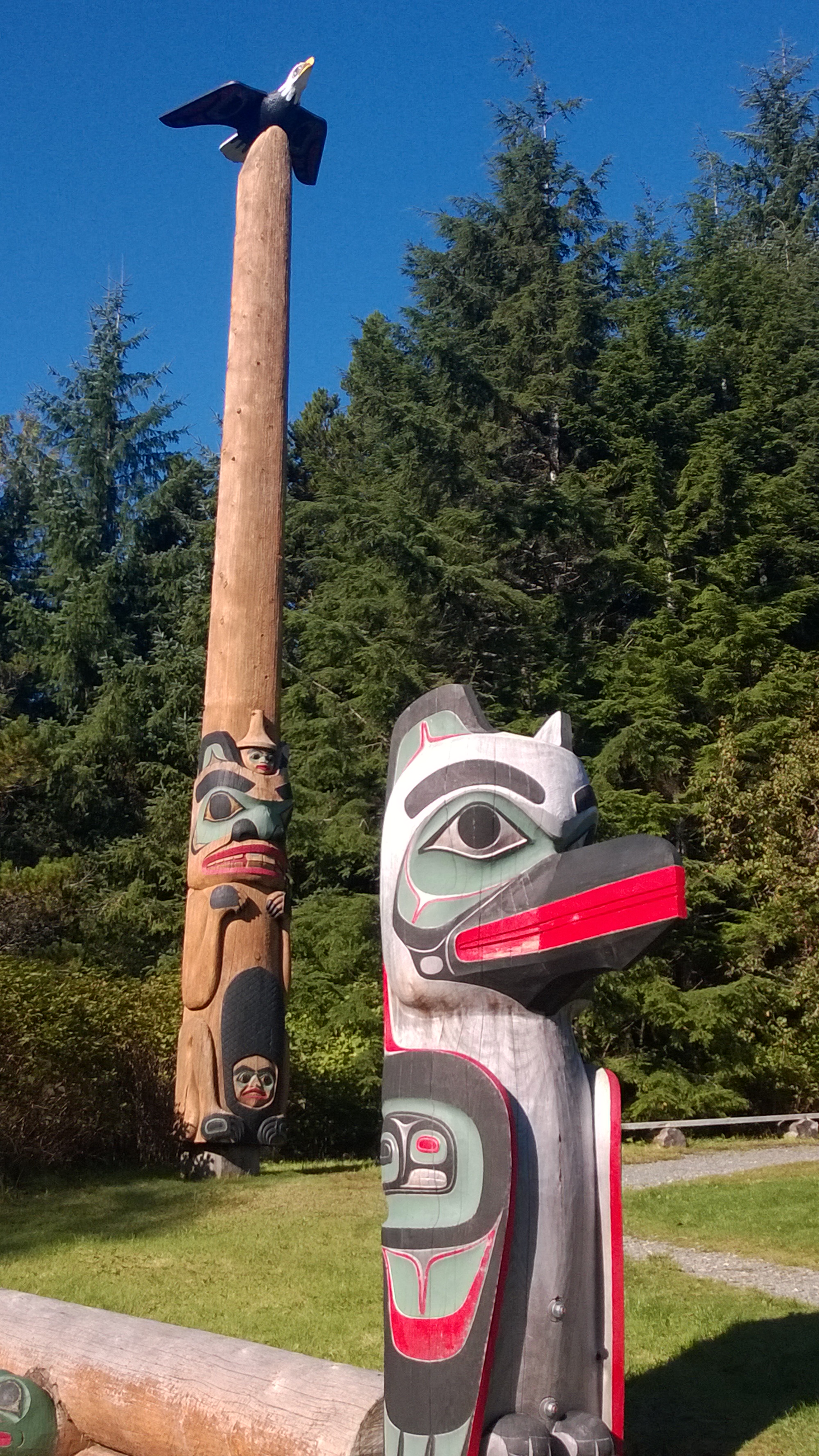
A barren sandspit on the southwest corner of Malcolm Island, Pulteney Point marks the separation of Broughton and Queen Charlotte Straits. Named in 1846 after Admiral Sir Pulteney Malcom, a Scottish-born British Naval Officer, famous for chasing the French fleet all the way to the West Indies following the Battle of Gibraltar. Kwakiutl legends say the island rose up from the water and someday it would return to its watery grave. For this reason, the natives never inhabited the island although they did harvest cedar for ceremonial masks and totem poles.

In 1900, a group of Finnish immigrant coal miners in Nanaimo petitioned Canada for a piece of land to escape their miserable working conditions and create a Utopian community. They were given Malcom Island. Sointula—the Finnish name of the island’s main town—means “a place of harmony.”  The Finns petitioned for a lighthouse to be built at Pulteney Point in 1905 and their descendants served as lightkeepers for the next 100 years.  In 1942, the nearby Estevan Lighthouse was shelled by the Japanese, and all lights along the West Coast were ordered to “go dark.”  With no light to guide her, the Alaska Steamship Company’s Columbia ran aground on the spit.

In June 1792, dealing with poor weather and dwindling food supplies near here, Captain Vancouver encountered the Spanish ships Sutil and Mexicana under the respective commands of Captain Galiano and Valdes.  Both were exploring and mapping the Strait of Georgia, seeking a possible Northwest Passage and were also trying to determine if Vancouver Island was in fact an island or part of the mainland. The two commanders agreed to assist one another by dividing up the surveying work and sharing charts. Working together until early July, they then split up:  the British ships circumnavigating the island starting in the Strait of Juan de Fuca and navigating east and north, while the Spanish ships started in Nootka on the West Coast navigating west and north. 

On July 19, 1792, Captain Vancouver traded sheet copper and blue cloth for sea otter skins at Nimpkish, just south of present-day Port McNeill. Lieutenant Broughton wrote, “In the afternoon, I went with Capt. Vancouver and some of the officers accompanied by the Chief to the Village. We found it pleasantly situated, exposed to a Southern aspect, on the sloping bank of a small creek well sheltered behind a dense forest of tall pines. The houses were regularly arranged and from the Creek made a picturesque appearance by the various rude paintings with which fronts were adorned. On our approach to the landing place in the two boats, several of the natives assembled on the beach to receive us and conducted us very orderly through every part of the village. We observed the houses were built very much in the same manner as Nootka, but much neater and the Inhabitants being of the same Nation differed very little either in their manners or dress from the Nootka tribe. Several families lived in common under the same roof, but each had their sleeping place divided off and screened in with great decency and a degree of privacy not attended to in the Nootka inhabitations.  The Women were variously employed, some in culinary occupations, others were engaged in Manufacturing of Garments, Mats and small Baskets and they did not fail to dun us for presents in every House we came to in a manner which convinced us they were not unaccustomed to such Visitants. Buttons, Beads and other Trinkets were distributed amongst them and so eagerly solicitous were they for these little articles of ornament that our pockets were soon emptied of them & tho they were free & unreserved in their manners & conversation, yet none of them would suffer any of our people to offer them any indecent familiarities, which is a modesty of some measure characteristic of their Tribe. On coming to an elderly Chief’s House we were entertained with a song which was by no means unharmonious, the whole group at intervals joind in it & kept time by beating against planks or any thing near them with the greatest regularity, after which the old Chief presented each of us with a slip of Sea Otter Skin and sufferd us to depart.”

Perhaps fitting the Broughton Archipelago Marine Park, established in 1992, was named after this Lieutenant who so vividly described early explorations 220 years earlier. The Park lies east of Malcolm Island and is British Columbia’s largest marine park with dozens of undeveloped islands, sheltered waters, and peaceful anchorages framed by tall peaks of the coastal mountain range to the east. A mecca for sea kayakers from around the world, I can’t help but wonder what Lieutenant Broughton would write about this wilderness today.

As we swing around Ledge Point to the marina, tiny Haddington Island, a mere 98 acres, is directly off our bow. Formed more than 3.7 million years ago as the Juan de Fuca plate to the west, subducted under the North American Plate, the island’s blue-grey to buff-colored andesite rock, prized for stone carving and sculpture, can be found on some of the province’s most famous buildings:  The Empress Hotel and Parliament buildings in Victoria and the Vancouver Art Gallery, Hotel Vancouver and Vancouver City Hall.

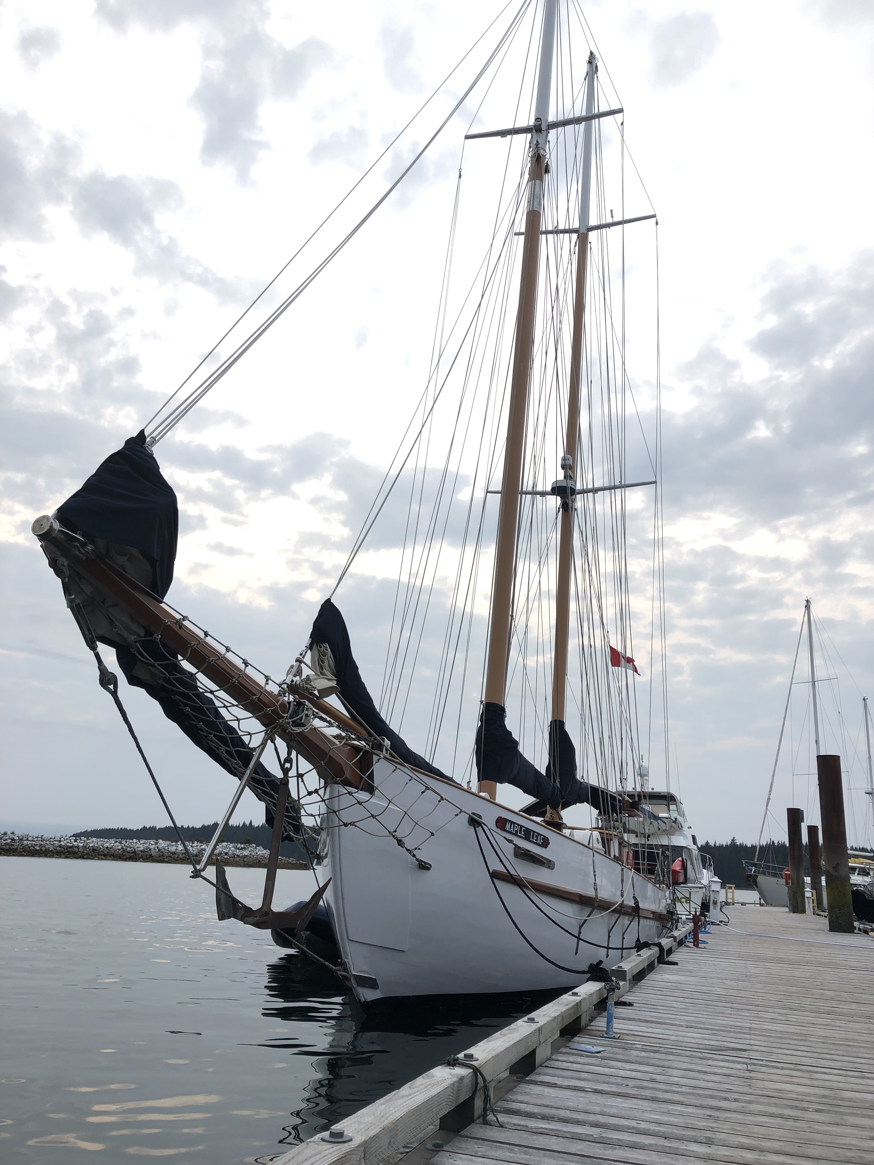
As it’s the height of summer, the docks are crowded with all sizes of pleasure boats, yachts, even tall-masted schooners. Our berth is a tight squeeze between two other boats. After tying up for the night, we enjoy fresh Halibut fish & chips at the local pub.

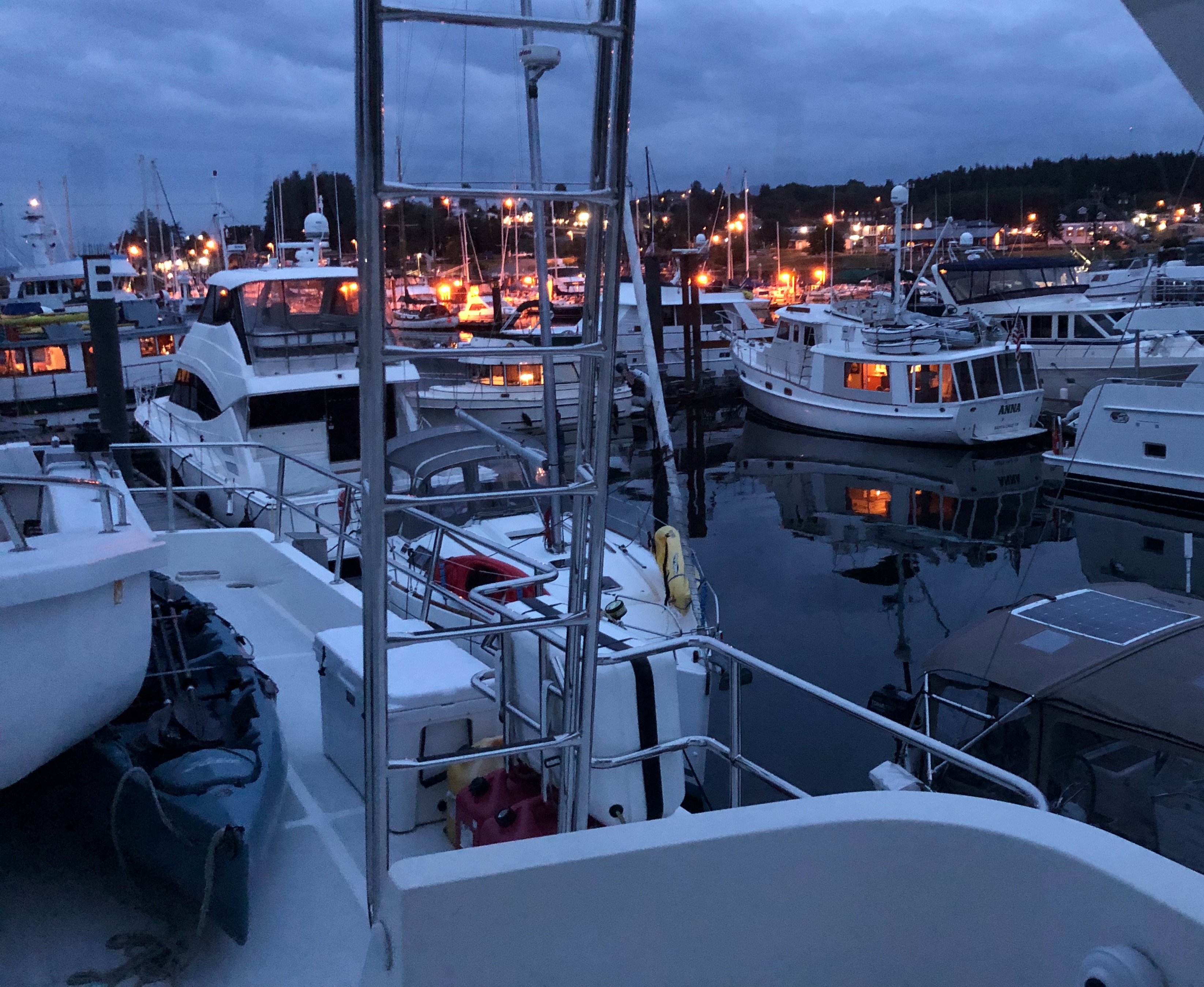
The marina is magical as dusk deepens to night and boat lights reflect on the water.  On our last night aboard, I also reflect on our remarkable journey.  We were always connected to civilization by radio and GPS, never too far from a friendly port to stock up on provisions, a safe harbor or anchorage for the night easily identified on our nautical charts.

Yet with all these advantages today, boats still sink or run aground. I can’t help but wonder about the early explorers of these vast—and then largely uncharted—waters.  The men whose writings I have read and quoted in this blog. Their primitive wooden ships. Their meager supplies dependent on successful fishing or hunting for food on the islands. Their families not hearing from them for years at a time. Those who did not survive. 

My friends think I am brave to sail the Inside Passage in a relatively small boat.  Adventurous maybe.  But “brave” is a word that belongs to those early sailors.

© Copyright 2012-2023. Lisa Scattaregia. All rights reserved.

The Inside Passage — Ketchikan to Prince Rupert — July 28, 2019

We are underway at 4:52 am, the streetlights of Ketchikan still shining in the morning twilight. Sailing south in Tongass Narrows, we will pass Saxman Village, the largest collection of totem poles in the world. Chilkoot Tlingit and Haida artisans still carve totem poles out of carefully selected Western Red Cedar logs. 

First noticed by European explorers in the 1700s, totem poles were misunderstood. Captain James Cook, who saw totem poles off the coast of British Columbia near Tofino, called them “truly monstrous figures.”  Even today, when someone refers to the “low man on the totem pole” they may not realize that the bottom figure was usually the most important one – and it was not a man.  It might have been the orca, raven or salmon.

Early totem poles were billboards for rich and powerful native families, telling stories about the family and the rights and privileges they enjoyed. With early traders came more wealth, and more poles, some 19th-century native villages had hundreds of totem poles, each one shouting out the power and wealth of the family behind it. Early missionaries thought the totem poles were worshiped as gods and encouraged them to be burned.

Before iron and steel arrived in the area, natives used crude tools made of stone, shells, or beaver teeth for carving. The process was slow and laborious; axes were unknown. By the late eighteenth century, the use of metal cutting tools enabled more complex carvings and increased production of totem poles. The tall, monumental poles in front of native homes in coastal villages probably did not appear until the early 1800s.

A highlight on one of my earlier visits to Ketchikan, I had watched the white-haired and revered carver Nathan Jackson at work on a ceremonial canoe in the Carving Shed, a small woodshop on the site. Just outside the shed, the choicest cedar logs are marked with initials “NJ” waiting for him to transform them into stunning works of art.

In the 19th century, Tongass Village was famous for the dozens of giant totem poles standing guard in front of longhouses.  Prospectors from the gold fields reported finding a totem pole with an actual telescope attached to the top bearing the inscription “James Cook 1778.” Village elders explained the telescope had been a treasured gift from a white man to their fathers.  In 1899, the Seattle Chamber of Commerce and the Seattle Post Intelligencer sponsored a tour of Alaska aboard the sloop City of Seattle.  They removed one of the giant totem poles from the deserted Tongass Village, sawing it in half in order to get it on board.  After it was erected in Pioneer Square, the Tongass villagers claimed theft and demanded its immediate return.  Eventually, the city paid for the pole, and it was allowed to remain in Seattle. 

We skirt Race Point and head toward Spire Island Reef, where the famous gold ship Portland went aground on the evening of December 20, 1905. More than 100 years later, it is easy to forget it was the Alaska Gold Rush that put Ketchikan—and also Seattle—on the map.

The white hulk of the Norwegian Splendor, a symbol of the modern gold rush, rumbles into view as she approaches the Tongass Narrows bound for Ketchikan.  Tourists are already on the bow and flashes from their cellphone cameras flicker like fireflies. Our radio crackles with a woman’s voice alerting us “. . .pleasure vessel Well Sea approaching to pass . . .” and she also signals the tug pulling a large barge a few hundred yards behind us. They intend to pass us both port-to-port in the narrow channel.  I smile. Only officers are permitted on the Bridge during Red Manning (nautical protocol when a ship is coming into port) so the woman’s voice is a rarity in the cruise industry—a female Senior Officer on the Bridge.

I study our chart book, Skagway to Barkley Sound, and realize the people onboard this cruise ship will not see any of what we will today.  Their ship has run all night while they slept, they will disembark for a few hours in Ketchikan, and then the ship will run again all night to the next port.  A similar timetable repeated by nearly all the cruise companies.

Speaking of maps, while Vancouver seemed to name everything after men of the era or men on his ship, gender equality seems to exist at least in this corner of the wilderness. We are passing Annette Island to starboard, named by William Dall for his wife in 1879. Admiral Winslow who cruised past here while on board the U.S.S. Saranac in 1872 named the sweet little island to our port after his daughter Mary. Helen Todd Lake was named for a woman pilot from Ketchikan who was killed when her plane crashed here in 1965.

Point Alava, which Vancouver named after the Spanish governor (no surprise another man), is where we head south into Revillagigedo Channel, named by the Spanish explorer Camano after Juan Vicente de Guemes, the 2nd Count of Revillagigedo and Viceroy of New Spain in 1793.  A vast area, New Spain included what is now the West and Southwest U.S. from California to Louisiana to Florida, parts of Wyoming, as well as Mexico, Central America, the Caribbean, and the Pacific Coast to Alaska.

The chart of Cape Northumberland, an area noted for extreme magnetic disturbance, notes many plane crashes in the area including a Pan Am DC-4 which crashed on Tongass Mountain in 1947 killing all 18 people.

In the narrows, a tug calls us on the radio advising he would like to overtake us on our port.  “Roger that,” replies my friend as he slows to six knots to give the tug and barge a wide berth.  Many people in the continental U.S. are unaware that the west coast of Alaska and British Columbia is actually a vast archipelago, more than a thousand islands spanning thousands of miles. Tugs towing barges ply these watery highways delivering everything from building materials to appliances to new cars.  Ferries and float planes are the other principal modes of transportation to many of the small, isolated communities on these islands.

We skirt Tongass Island, the site of Fort Tongass established soon after the United States purchased Alaska from Russia.  In the summer of 1868, it was a small tent encampment with 60 men.

The historic notes on our charts indicate there were once fox farms on the nearby islands during the 1920s when fox furs with heads and tails still attached were in fashion in Chicago and New York. There were also quarries for slate, marble and limestone, as well as gold and copper mines; however, most notations on these islands reference canneries, fisheries, and packing houses.

I’m fascinated by the fact that Dickens Point was named after Lieutenant Sydney Smith Haldimand Dickens, the fifth son of Charles Dickens, the great novelist of the Victorian era.  Dickens who had 10 children created those memorable characters in books we all studied in high school: Oliver Twist, David Copperfield, Great Expectations and The Tale of Two Cities. Sydney, who Dickens called a “born little sailor,” joined the Royal Navy at age 14 as a cadet on the HMS Britannia. Sydney was just 22 when sailed these waters in 1868.  Reportedly an actor of some talent, his role in a theatrical performance in Victoria that same year was the inspiration for Captain Pender naming the rocky outcropping after the young Lieutenant.  While Charles Dickens is buried in Poets’ Corner in Westminster Abbey, his young son died on a passage home from India to England and was buried at sea in the Indian Ocean.  He was just 26 years old, had never married, and had no children. But he had explored this corner of the world when these waters were still brimming with sea otters, hundreds of whales, and 75-pound King salmon.

As we enter Chatham Sound, there are clusters of small islands in all directions but it’s starting to rain obscuring the details in a silvery gray mist.  I curl up for a nap on the bench in the pilot house, the hum of our engines lulling me to sleep.

I wake as we pass Digby Island and start our approach to Prince Rupert.  The name of this busy port was selected by an open competition by the Grand Trunk Pacific Railroad with a prize of $250–a large sum in those days.  More than 12,000 people submitted ideas that met the criteria:  the name could not be more than 10 letters and not more than three syllables.  Two people submitted “Port Rupert” and Miss Eleanor MacDonald of Winnepeg submitted “Prince Rupert” after the illustrious soldier and explorer (the only person to submit his name).  In the spirit of fairness, the Committee decided to award $250 to all three.

Our overnight anchorage is a picturesque marina where I spend a pleasant hour watching fisherman clean salmon and feed the tailings to a friendly family of harbor seals.  With each passing mile today, time moves more slowly, and the modern world is further away.

© Copyright 2012-2023. Lisa Scattaregia. All rights reserved.

The Inside Passage — Ketchikan July 27, 2019

My friend, a master mariner, has been hired to reposition a 70-foot motor yacht for clients who have finished their trip and are flying home. Starting in Ketchikan, Alaska, we will have the boat to ourselves for the 500 nautical mile journey down the Inside Passage to April Point on the east side of Vancouver Island, British Columbia.  It will take us five days, traveling at an average speed of ten knots, for eight to ten hours each day.

More importantly, it’s a rare opportunity to document this wilderness in its current state before it disappears as recent legislation will open drilling and logging in one of the most pristine places on the continent. I’ll be journaling and taking photographs along our route.

A light rain and misty skies greet us when we land in Ketchikan.  This small fishing village holds a treasure trove of memories for me. 

In the early 1900s, Ketchikan was the Salmon Capital of the World.  Dozens of canneries lined the wharves and sturdy wooden fishing ships unloaded their silvery bounty. The fish were processed and canned in short order. As many as 850,000 cans a year left Ketchikan bound for kitchens across the country where they were turned into salmon croquettes at a time when formal place settings for dinner included fish forks for a fish course.

In 2019, the canneries are long gone, native salmon are an endangered species, and gargantuan cruise ships jostle for dock space. On this rainy day, thousands of tourists from Norwegian, Viking and Disney ships crowd the narrow streets looking for trinkets in androgynous shops which all sell the same souvenirs.  If they are hoping to discover Alaska, they will not find it here.

Ironically, it was a cruise ship that first brought me to Ketchikan in 2012.  I had just started working as a contractor in the office of Holland America Line and since I had never been on a cruise ship, my boss encouraged me to take a cruise. Having explored Puget Sound, the San Juans and Gulf Islands on small sailboats and motorboats with my former husband in the 1990s, I was reluctant. When we spotted those behemoth cruise ships in the distance, we were unanimous in our disdain, vowing never to sail on one. 

In 2010, at a time when my life was unraveling with personal challenges and a divorce, I had watched the lights of cruise ships passing in the night on the Strait of Juan de Fuca from our living room high on a hill in Sequim. I had wondered about those who had the financial wherewithal to book passage during the worst recession since the Great Depression. And I wondered too if I would ever be solvent and whole again.

Today, it seems serendipitous it was also late July when my son, his godparents, their daughter, son-in-law and three small children had sailed from Seattle on the ms Oosterdam–my first cruise of many related to my work. I had bought my son his first sport coat and tie for formal dinners in the dining room and we had celebrated his 15th birthday on board. He had relished being able to order whatever he wanted at dinner followed by late-night milkshakes from room service.

But it was a rainy day in Ketchikan that held the sweetest memories of that trip.  In a back alley off the main street, we had stumbled upon the bright red funicular for the Cape Fox Inn that sits atop a steep bluff.  It was just the two of us that morning. “Let’s see where it goes,” I suggested. To our pleasant surprise, there was a restaurant at the top with lovely views of the harbor.  We lingered over pancakes, elk sausage, and second cups of coffee and hot chocolate. Just talking about life and possibilities for his future. 

After breakfast, my son and I wandered into a small shop off a back alley. He stood admiring a case of knives with scrimshaw carvings on handles made of pale ivory-colored bone. Impulsively, I told him to pick one he liked as a birthday present. We spent a good 30 minutes while he examined his options; finally choosing one etched with an eagle and fir trees. He beamed with excitement as they wrapped it.

The following spring, he would forget it was in a jacket pocket and the precious knife would be confiscated at his high school. Despite my explaining its sentimental value, the Vice Principal insisted the knife would be destroyed and not returned.

Then in 2015, I was back in Ketchikan working for the company and staying at the Cape Fox Inn. Each day, I would visit another one of our ships to train officers and crew as they docked in port for the day, returning to the inn each night. I was now an employee enjoying my work and making good money. I had been able to buy a charming 1907 Craftsman house on a tree-lined street in a great old Seattle neighborhood. The mortgage was about the same as renting a small apartment in Seattle. Life was infinitely better.

So, one afternoon, I found the little shop again and purchased a knife for my son to replace the one that had been confiscated. To my dismay during the security check on my flight back to Seattle, although packaged and sealed, this knife was also confiscated.

This afternoon after we clean the yacht and stock up on provisions at the local Safeway, I take a walk in the rain, where I hope to find a talisman from the past.

By instinct, my footsteps follow the wooden walkway to the funicular, but it is closed this dreary afternoon. A shopkeeper explains the tram keeps breaking down and is awaiting repairs. Turning right, I navigate by memory into a narrow shop that sits on stilts above Frenchman’s Creek.  Moving from displays of Alaska-themed T-shirts and waterproof parkas, to a room full of moose mugs, miniature totem poles and grizzly bear tchotchkes, finally to a small interior room with display cases full of pocketknives, Swiss Army knives and wicked blades of various sizes and shapes.

The young attendant laughs as I recount the story of two previously purchased and confiscated knives. 

“Let’s hope the third time’s the charm,” I quip. 

“Some of the cruise ships won’t allow these depending on the length of the blade,” he cautions.

“Thankfully, we’re not on a cruise ship, we’re on a private boat,” I explain.

I select a lovely small knife with a curved scrimshaw handle delicately etched with an eagle and fir trees. The cost is more than double what I paid for the first knife.  As they run my credit card, the fact I no longer worry about the cost is a testament to how much my finances have improved over the last few years.

I smile. The 15-year-old boy who had stood deliberating choices at the glass case would be turning 22 in August and his three-year tour of duty as a Bradley Assault Vehicle/tank driver in the Army would be ending in November. This was a future neither of us had envisioned that long ago rainy morning.  The cashier places the knife in a small velvet pouch.  As I tuck it into my purse, I look forward to seeing my son’s face when he unwraps it at Christmas.

After the last cruise ships depart and all the floatplanes have been tethered for the evening, the mist clears on the Tongass Narrows. It is still light at 9:30 pm as we watch two majestic eagles atop the piling next to our boat.

Strange sometimes the paths we travel to come full circle.

© Copyright 2012-2023. Lisa Scattaregia. All rights reserved.

Website Built with WordPress.com.

Up ↑